Environmental Engineering Reference
In-Depth Information
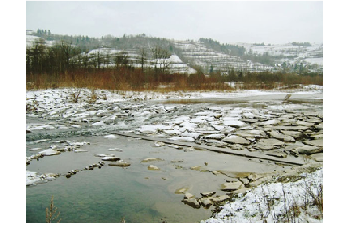
Fig. 5.9 Ramp
—
close to nature structure used in mountain rivers
to the RHS regulated reach, the rocky bed had been developed (Fig.
5.8
) (Krzemie
ń
1976
,
1984
; Radecki-Pawlik et al.
2010
,
2013
; Plesi
ski et al.
2013
).
In this middle run, the river passes also two high steps damming up water for the
power plant. The Por
ń
bianka in the lower run used to be a braided river but now its
channel has been regulated by 25 ramps (rapid hydraulic structures, RHS, Fig.
5.9
).
After introducing ramps, the channel has straightened and had changed its mor-
phodynamics. As long as
ę
floods passing this river are violent, the rapid hydraulic
structures will demand periodic reparations.
fl
The Czarny Dunajec River
Czarny Dunajec has its sources in the Tatra mountains. The river joins the Bia
ł
y
Dunajec River in the city of Nowy Targ, creating the Dunajec River. The
ow
dynamics of the Czarny Dunajec River is high. Nearly the whole area between the
village of Podczerwone and the town of Nowy Targ is regulated with step cor-
rection and bank forti
fl
wka, there is only one,
approximately 4 km-long segment of the river in which the channel is not regulated,
preserving original character. In the highest two-and-a-half-kilometre-long reach
the Czarny Dunajec River is braided and downstream it changes to island-braided
(Wy
cations. Below the village of Wr
ó
bl
ó
ga et al.
2010b
). In the above-mentioned part, the river creates complex bends
which mark the migration zone of about 400 m width. There are numerous areas
where the terrain is wetted as localized lower (Fig.
5.10
). The whole valley is
covered with abundant
ż
fl
flora. Away from the course, in inundation terraces, there are
fields used for agricultural purposes. The area of the river and the valley is protected
Search WWH ::

Custom Search