Environmental Engineering Reference
In-Depth Information
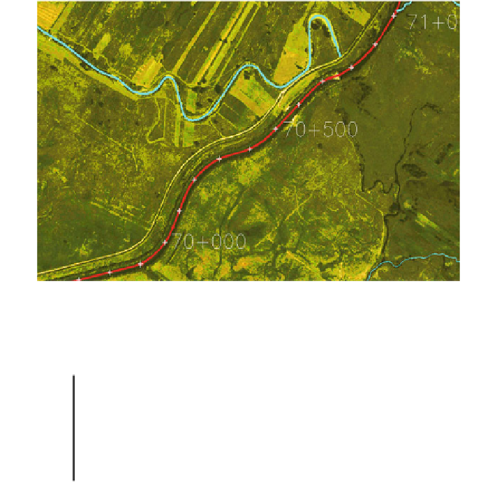
Fig. 5.7 The curvature comparison of the natural (blue) and regulated (red) river channel
Table 5.2 Expected change of parameters characterizing the river channel
fl
ow and the
fl
floodplain
inundation
Parameter
River
width (m)
River
depth (m)
Flooded area
(Q1 %)
(mln m
2
)
Valley capac-
ity (Q1 %)
(mln m
3
)
Water depth in the
valley during flood
(Q1 %) (m)
Current
state
25
0.6
7.6
4.7
1.2
After
restoration
14
-
50
0.4
-
0.8
11.2
8.7
0.8
transportation and instability of the bed during
flood events. The curvature of the
natural channel differs dramatically in comparison to the regulated ones (Fig.
5.7
).
The multichannel system is well developed. To provide calculations of the
fl
fl
ow
distribution within the modi
ed or restored river channels, the HEC-RAS calcu-
lation has been performed. The parameters of regulated and restored river channels
are gathered in Table
5.2
.
The comparison of width and depth of the Nida branches shows that the
expected width of the natural bed is about 34 m and the depth should vary from
0.5 to 1 m.
As long as the river was natural within the broader valley, it used to redistribute
water periodically within the different parts of
. The restoration works should
start from rebuilding proper connections between the old channels as well as ini-
tiating the water redistribution within the whole channel system. There is no cer-
tainty that on the sandy substratum of the valley the in
“
delta
”
ltrated water could be
limited to the acceptable level. In the past within the
region Nida had
naturally hold one or two main channels (Fig.
5.1
). For this reason, only part of the
“
delta
”


Search WWH ::

Custom Search