Civil Engineering Reference
In-Depth Information
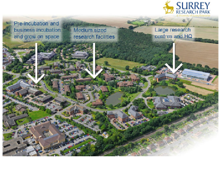
Fig. 5 Aerial photograph of the Surrey Research Park 2012, This shows the three zones of
development for small, medium and large companies on which the master plan for the site is
based
businesses, research centres for large technology based companies and facilities
for high value manufacturing activities such as building satellites (Fig.
5
).
In addition to this broad zoning plan which was proposed by the University, a
number of other planning criteria were imposed by the town's planning department
as part of the agreed Master Plan. This covered such matters as the width of access
roads, parking ratios of 1 car space to 23 m
2
of gross space, building lines,
architectural style, building materials, building heights, the density of development
(25 %), building footprints (15 %) the principle of screening cars behind buildings
and a landscape plan.
The total permitted area under the 1984 planning permission allowed
71,250 m
2
of gross external space. The original intention was to develop the whole
site by 1991 but the University, by undertaking the development itself, has been
cautious and has built at a lower rate. In 2012 the development had reach 90 %
completion. Between 1983 and 1994 the University developed the site by con-
structing a series of speculative projects for SMEs. The policy since 1994 has been
to build to order rather than as speculative developments. Part of the logic for this
shift in strategy was that by 1994 the areas of the site allocated to small start up
and grown on space had been fully developed.
Details of the rate of build of space on the Surrey Research Park are noted in
Fig.
6
.
Search WWH ::

Custom Search