Graphics Programs Reference
In-Depth Information
Mixed units
The terrain data has to be corrected because it has been built with mixed units.
The horizontal coordinate values are in meters while the elevation values are
in feet. Applying a scale factor of 0.3048 in the Z direction converts the feet to
meters so that the mountains display at their proper height. This is an example of
“knowing your data.” You will often have to make these types of adjustments to
get all of the various types and sources of data within a typical InfraWorks model
to sync up. Figures 2.11 and 2.12 show the terrain data without this correction.
11.
Click Close & Refresh.
After a pause, the light blue tiles and hourglasses will appear. Then
after a little more time you will see that a portion of the model is
now shown with 3D terrain.
12.
Click the top southwest corner of the ViewCube to set the model to a
southwest isometric view. Then move your cursor to the center of the
screen and roll the mouse wheel forward to zoom in and view the ter-
rain model.
It should appear similar to Figure 2.14.
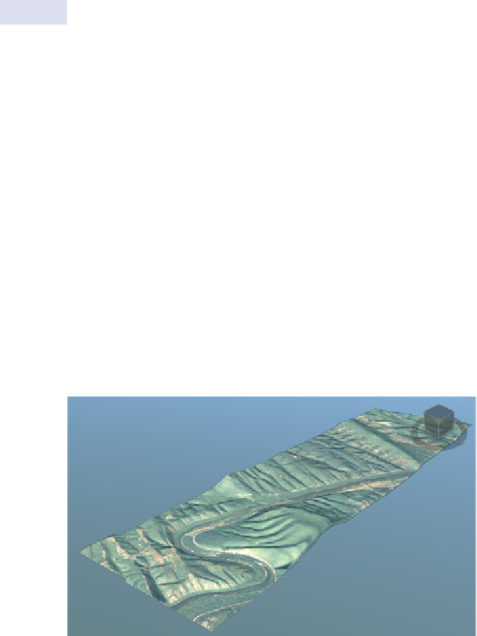
fIgure 2.14
Terrain data imported into InfraWorks
Interestingly, most of the aerial photography has disappeared with
the exception of the area represented by the terrain. When you import
imagery into InfraWorks without a terrain to drape it on, InfraWorks


Search WWH ::

Custom Search