Graphics Programs Reference
In-Depth Information
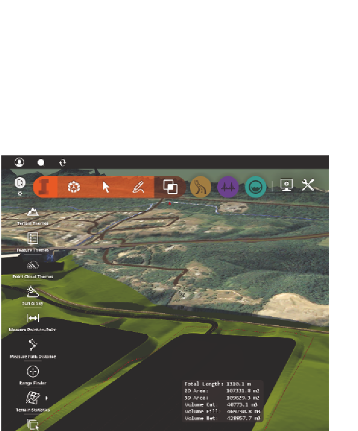
provide answers relating to the amount of earthmoving required to build your
design. Fortunately, the Terrain Statistics command makes this quite easy.
You launch the command by first clicking the Analyze icon on the InfraWorks
toolbar and then clicking Terrain Statistics on the side toolbar. You will be
prompted to click a series of points to draw a shape around the area you would
like to analyze. Within the area you've identified, InfraWorks will then compare
your original terrain to the shape of the coverages and report important infor-
mation to you (see Figure 7.11).
1
2
3
fIgure 7.11
You can launch the Terrain Statistics command by clicking the icons in
the order shown.
using terrain themes
A terrain theme uses colored areas to tell you a story about the elevation, slope,
or aspect (the direction in which hillsides are facing) of your terrain. It analyzes
the existing and proposed terrains together, as though the design has been
built. You start creating terrain themes by clicking the Analyze icon on the


Search WWH ::

Custom Search