Graphics Programs Reference
In-Depth Information
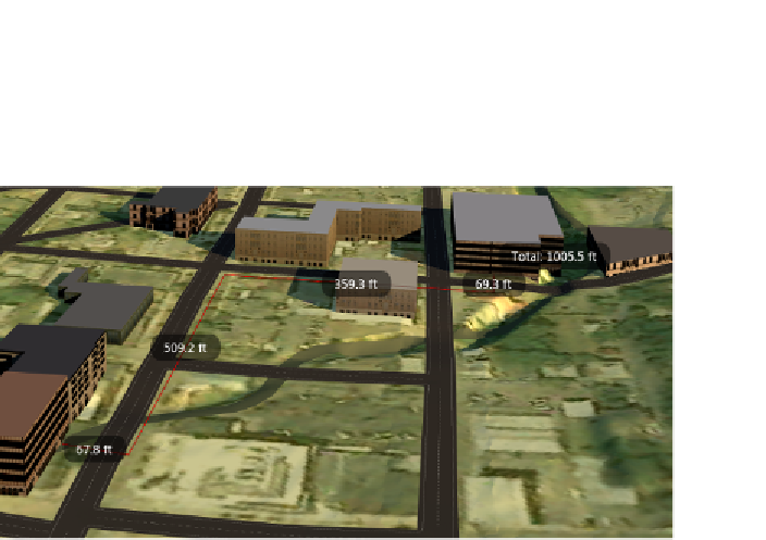
If you are using the Measure Path Distance command, you will see multiple
two-point measurements arranged end to end along with an overall distance
value (see Figure 7.3).
fIgure 7.3
Measurements created using the Measure Path Distance command
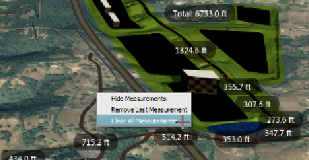
There are a few more things to note about InfraWorks measurements. The
first is that the reported measurement is a 3D distance based on the elevation
of the terrain. The second is that measurements are “temporary,” meaning that
they will disappear when you start a new command or press the Esc key. Finally,
while using the measurement commands, you can right-click to gain access to
three commands: Show/Hide Measurements, Remove Last Measurement, and
Clear All Measurements (see Figure 7.4).
fIgure 7.4
The shortcut menu for the measurement
commands
Search WWH ::

Custom Search