Graphics Programs Reference
In-Depth Information
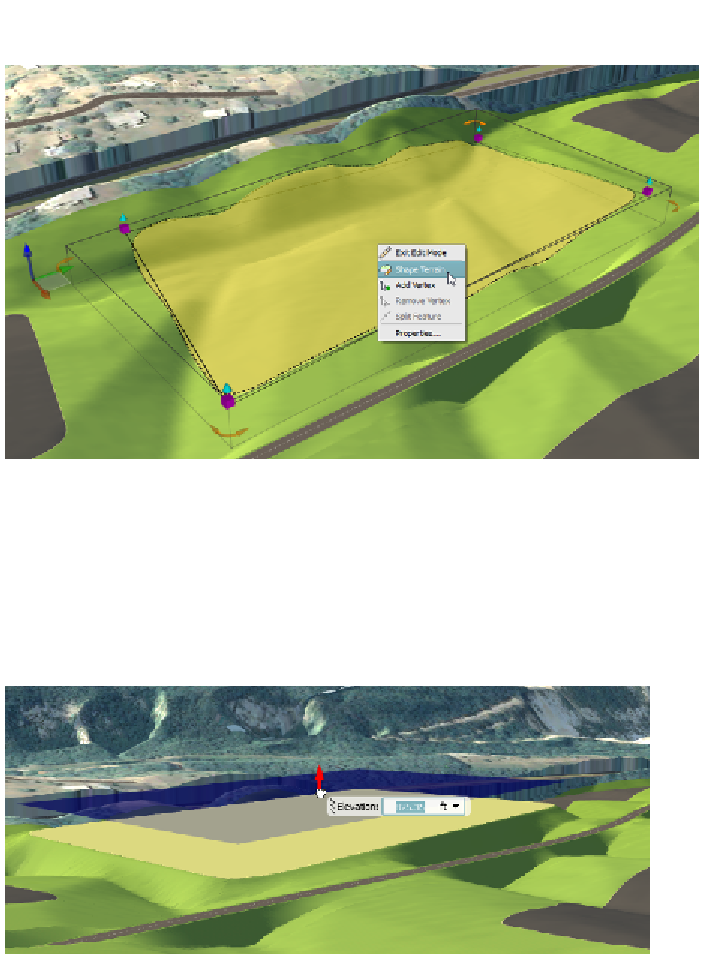
fIgure 3.27
Launching the Shape Terrain command for a coverage
This command will introduce a new gizmo that will appear as a blue vertical
arrow in the center of the coverage. When you click and drag this arrow, it will
set all vertices to the same elevation (see Figure 3.28). The arrow will turn red
indicating that it is active and in use. You can also use a tooltip to provide the
elevation numerically.
fIgure 3.28
The Shape Terrain command is used to set the elevation of a coverage.
When you click Shape Terrain, the program takes on a sort of shape terrain
mode and now, whenever you click a coverage, the blue arrow will appear and
you will not see the perimeter gizmos. To return to edit vertex mode, you right-
click again and select Edit Vertices, as shown in Figure 3.29.
Search WWH ::

Custom Search