Graphics Programs Reference
In-Depth Information
or the standard line. These areas are important because they correspond to the regions
of least distortion in the map. The difference between the various projection algorithms
is in the precise way they project points on the sphere to the developable surface.
Definitions of secant
Line, ray, or segment that contains a chord of a circle.
A line that crosses the circle only twice.
A line extending through a circle, connecting two nonadjacent points.
A straight line that intersects a curve at two or more points.
Ratio of the hypotenuse to the adjacent side of a right-angle triangle.
Figure 4.49 shows how the orientation of the developable surface can vary relative
to the poles of the globe. The surface can be polar, equatorial, or oblique. It is obvious
that the orientation significantly affects the graticule and thus the appearance of the
map. In the oblique projections, the poles are no longer at the top and bottom of the
map but have migrated to unexpected places.
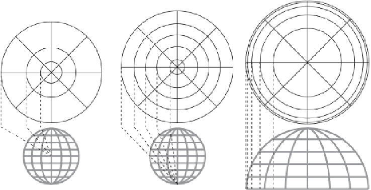
Azimuthal projections
, also called
planar projections
, are those that project (nor-
mally only part of) a sphere directly to a plane, so there is no need to unroll and flatten
a developable surface. The plane is tangent to the sphere at a point that becomes the
center of projection. If the center is a pole, then lines of latitude become concentric
circles on the projection and lines of longitude become straight segments that converge
at the center. Figure 4.48 shows that these projections preserve directions from the
center but distort distances and areas as well as directions from other points.
(a)
(b)
(c)
Figure 4.48: Azimuthal Projections.
The case where the center of projection is at the center of the sphere is called a
gnomonic projection [part (a) of the figure]. Each line of latitude becomes a circle, but


Search WWH ::

Custom Search