Agriculture Reference
In-Depth Information
1
2
3
4
5
6
7
8
9
10
11
12
13
14
15
16
17
18
19
20
21
22
23
24
25
26
27
28
29
30
31
32
33
34
35
36
37
38
39
40
41
42
43
44
45
46
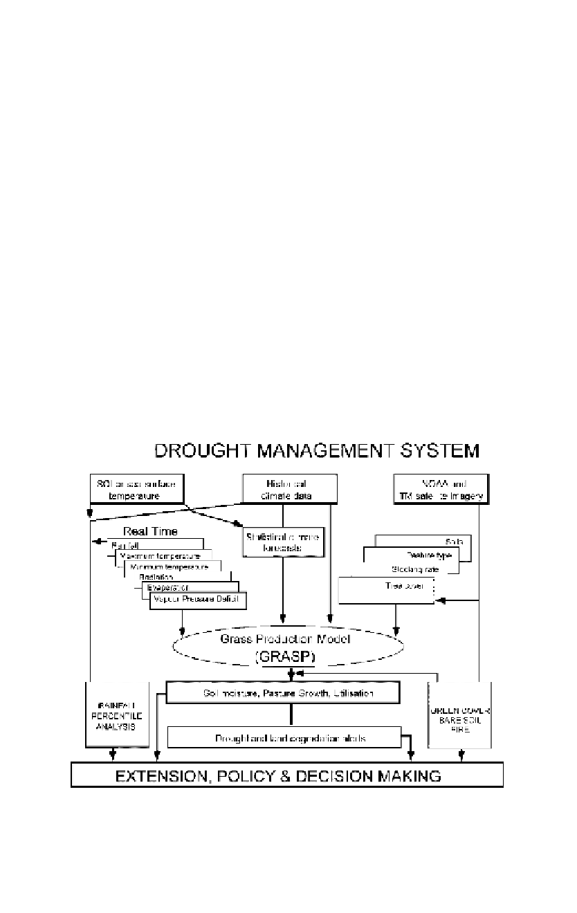
has developed a national modeling framework (figure 29.4) that is be-
ing used to monitor and forecast drought across Australia (AussieGRASS;
Carter et al., 2000;
http://insite.nrm.qld.gov.au/resourcenet/rsc/agrass).
Sp
atial Modeling Framework
The AussieGRASS spatial modeling framework (figure 29.4) allows agri-
cultural simulation models to be run at a continental scale on a 5-km
grid. The framework runs on a supercomputer and calculates daily out-
puts simultaneously across the continent. The framework is capable of ef-
ficiently running any daily time-step biological simulation model, provided
the model is recoded to simultaneously operate across all pixels. A graz-
ing system model, GRASP, (GRASs Production) is currently incorporated
in the modeling framework to operationally monitor drought across the
nation.
[377
Line
——
4.5
——
Norm
PgEn
Pa
sture Model
The GRASP model was developed as a generic plant growth model and has
been used to simulate growth of native pastures, sown pastures, and crops.
The soil water budget is simulated using four layers (0-10 cm, 10-50 cm,
50-100 cm, and a deeper layer available only to trees). Daily calculations
[377
Figure 29.4
The AussieGRASS modeling framework for drought monitoring and alerts.


Search WWH ::

Custom Search