Agriculture Reference
In-Depth Information
1
2
3
4
5
6
7
8
9
10
11
12
13
14
15
16
17
18
19
20
21
22
23
24
25
26
27
28
29
30
31
32
33
34
35
36
37
38
39
40
41
42
43
44
45
46
[292
Line
——
-0.0
——
Norm
PgEn
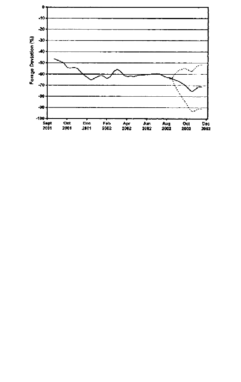
Figure 22.4
The deviation in forage standing crop for cattle compared to 30-year means of
da
ily standing crop for a rangeland community in southeastern Kenya, as estimated by the
Li
vestock Early Warning System. The dotted lines show the upper and lower 66% confidence
limits of 10- to 90-day projections.
and improved training of local extension officers. Issues of literacy, tradi-
tional pastoral decision-making processes, water availability, disease inci-
dence, and conflict must be considered in devising effective communication
instruments in pastoral communities.
[292
Re
flections on the Future
Agricultural practitioners, regardless of the decision environment, have
not had access to reliable production estimates relative to long-term data
in a spatially coherent manner. The emergence of geo-referenced weather
data, offered on-line in near-real time, coupled with automated modeling
environments, is ushering in a new suite of tools for the agricultural and
natural resource decision-maker. These tools could easily be integrated into
a suite of new tools that allow the emergence of highly integrated precision
landscape analysis systems, allowing decision-makers to explore issues of
crop production, disease risk, drought, hydrology, and market conditions
in a manner not experienced before.
Adapting models to the new realities of weather data systems (satellite-
based, radar, distributed ground-satellite-web linked systems) needs to be
considered in the near future. Higher resolution imagery, greater comput-
ing power, and stronger institutional collaboration on data sharing are go-
ing to make drought monitoring a more routine process that a wide array
of decision-makers can access.


Search WWH ::

Custom Search