Agriculture Reference
In-Depth Information
1
2
3
4
5
6
7
8
9
10
11
12
13
14
15
16
17
18
19
20
21
22
23
24
25
26
27
28
29
30
31
32
33
34
35
36
37
38
39
40
41
42
43
44
45
46
[133
Line
——
-0.9
——
Shor
PgEn
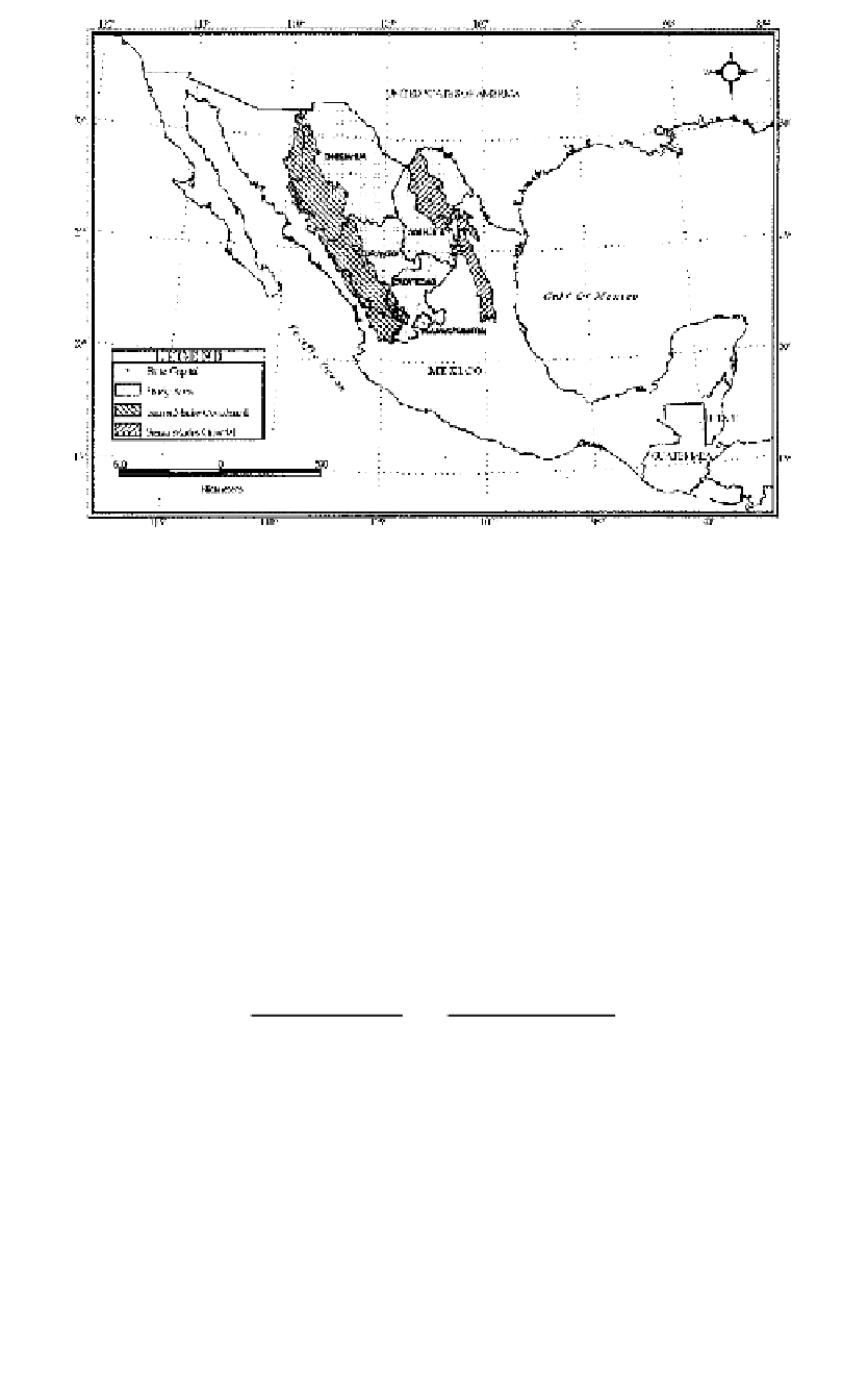
Figure 10.1
Five northern Mexican states selected for the study.
co
llected from the national climatic network. The national climatic net-
w
ork is spread throughout the country and is managed by the Servicio
M
eteorológico Nacional (SMN; i.e., National Meteorological Services).
Th
e CNA determines, for a municipal region, if the rainfall is equal to
or
less than one standard deviation from the long-term mean over a time
pe
riod of two or more consecutive months. If it is, then the secretary of
st
ate declares drought for the region. Based on such a definition, drought
w
as declared in 60 municipalities during 2000-01 and in 50 municipalities
du
ring 2001-02, out of 67 municipalities in the state of Chihuahua. If a
m
unicipality is declared drought-affected, it qualifies for federal funds for
dr
ought mitigation.
[133
Table 10.1 The distribution of irrigated and rainfed area in selected states of Mexico
Irrigated Area (
I
)
Rain-fed Area (
R
)
State
(ha)
(%)
(ha)
(%)
Area Ratio (
R
/
I
)
Aguascalientes
35,252
5.5
94,884
4.3
2.7
Coahuila
122,484
19.1
53,765
2.4
0.4
Chihuahua
265,410
41.3
634,129
28.6
2.4
Durango
98,762
15.4
508,880
22.9
5.2
Za
catecas
120,253
18.7
928,559
41.8
7.7
Total/Average
642,161
100
2,220,217
100
3.5


Search WWH ::

Custom Search