Environmental Engineering Reference
In-Depth Information
Modelling, Predicting Impacts
and Vulnerability Mapping
but does not qualify for traditional EA flood pro-
tection investment based on cost-benefit analysis.
Funded by the local Environment Agency Flood
Levy, a number of small flood storage ponds and
associated diversions have been installed that
have been proven to attenuate flooding, notably
for the September 2008 flood, which inundated
the nearby town of Morpeth. The Belford study is
yielding an abundance of good-quality data to
show how runoff propagates through small rural
areas and how flood waves can be attenuated
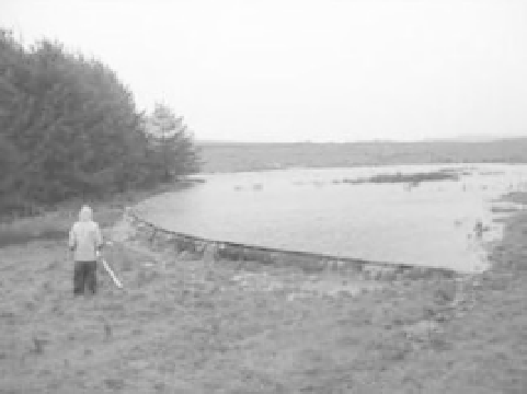
by small flood storage ponds (Fig. 2.7). Further
features are being installed including a large tem-
porary storage pond, which is large enough to
warrant a sluice gate (which will be operated by
the farmer); a woody debris zone in a forest loca-
tion, which is using locally felled trees to create
beaver dams and a rough floodplain inundation
area; a zone of willow barriers on the suitable
small floodplain zone; and a diversion structure
from the main road onto the farmers' fields and
into another large pond and more small ponds in
fields (10-20 in total).
Based on the data that are being collected, it is
intended that a generalized model of a system
of such mitigation features will be developed
that would allow the flood attenuation potential
of such interventions to be assessed at the catch-
ment scale, thus widening the portfolio of land use
management interventions that could be consid-
ered for catchment planning.
Modelling issues
Inanidealworld, thepredictionof thelikelyimpact
of future changes in land use/management would
use simple models that encapsulate knowledge
derived directly from comprehensive data on ob-
served impacts. Although new data are being col-
lected through the experiments described above,
they are site/catchment specific. To obtain predic-
tions of flood impacts for other catchments, we
must rely heavily on catchment rainfall-runoff
modelling, concentrating our efforts on how hy-
drological processes and change effects can be re-
presented in these models (O'Connell et al. 2007).
The following method is widely used to predict
the impact of changes in land use/management
(e.g. Bormann et al. 1999; De Roo et al. 2001;
Fohrer
et al. 2001; Niehoff
et al. 2002;
Liu et al. 2005; Brath et al. 2006):
1
Select the catchment rainfall-runoff model that
has the most appropriate representation of the
hydrological processes affected by the change.
2
Calibrate the model and run simulations of the
catchment in its state prior to change.
3
Alter the model's parameters to reflect the
change (this is where field data on change effects
can be used).
4
Run simulations using the altered parameters.
5
Estimate the impact, as the difference between
the simulated responses in steps 4 and 2.
On reviewing this method, and the wider prob-
lem of predicting impacts, O'Connell et al. (2007)
concluded that it raises some questions:
1
What is the most appropriate type of model for
the prediction of change?
2
Which hydrological processes need to be incor-
porated into a model, and in how much detail?
3
Which model parameters need to be altered to
reflect a change (and how can their values be
specified a priori)?
4
How can the uncertainty in the results be
quantified?
5
How can a model be validated for predicting
impacts?
Fig. 2.7
On-farm runoff storage at Belford.