Environmental Engineering Reference
In-Depth Information
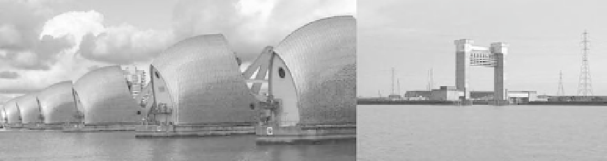
Fig. 23.2
The Thames Barrier (left) and Barking Barrier (right).
Upstream of the Thames Barrier, formal de-
fences exist in the form of raised walls, embank-
ments and demountable defences. The upstream
defences protect the area against normal high
tides, perhaps combined with reasonably high
(but not extreme) fluvial flow, ensuring that, for
the time being at least, the Barrier should only
have to close on a limited number of high tides
each year.
The Thames Barrier is only closed when the
forecast tide, in combination with the Thames
fluvial flow at Kingston, is likely to produce water
levels at LondonBridge that arewithin 0.4mof the
defence crest level at this point.
a 2D mathematical model of the floodplain
(Halcrow).
.
Flood Forecasting, using a 1D model to predict
highwater levels along the entireThames Estuary,
and a 2D floodplain model to analyse the impact
of breaching or overtopping (Halcrow and HR
Wallingford).
.
Analysis and appraisal of future flood risk man-
agement options using both 1D and 2D models as
part of the TE2100 project (Halcrow and HR
Wallingford).
The last four of these projects are described in the
following sections.
Extreme Water Levels
Overview of modelling on the Thames estuary
Introduction
Over the years several different hydraulic models
of the Thames Estuary have been developed, both
physical and mathematical. A number of organi-
zations have contributed to developing and refin-
ing these hydraulic models and they have been
extensively used on a variety of projects including:
.
Design of the Thames Barrier, which used
both early mathematical modelling, as well as
physical scale models, constructed at the Hydrau-
lic Research Station in Wallingford (now HR
Wallingford).
.
Assessment of extreme water levels, using an
in-bank one-dimensional computer model of the
Estuary and a detailed statistical analysis of
fluvial flows and surge tides (Halcrow and CEH
Wallingford).
.
Production of the Environment Agency's Flood
Map and 'Areas Benefiting from Defences', using
In 2005 and 2006 the Environment Agency
commissioned Halcrow to undertake two studies
to reassess design water levels, for a series of
annual probability (or return period) events, along
the Thames Estuary. Levels were produced for a
number of sites between Teddington and South-
end. The following sections provide an overview
of the methodology used to calculate the levels
and highlight some of the limitations inherent
with estimated extreme water levels.
Calculation of design water levels
The method used to estimate joint probability
water levels for different return periods is compli-
cated and involves several steps. The approach has
been reported more fully in Halcrow (2005) and in