Geography Reference
In-Depth Information
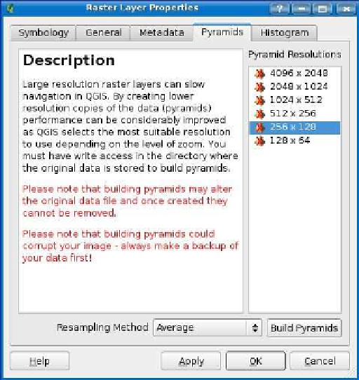
Figure 4.5: QGIS raster pyramids dialog box
This is appropriate because all that detail is lost on you at small scales.
QGIS supports building and using pyramids through the GDAL library.
Some software stores pyramids in external files, but GDAL builds and
stores them by default within the image itself. This means your original
image will be altered and in fact grow in size. You may want to make
a copy of the image before creating pyramids because the process is
not reversible. GDAL supports the creation of external pyramid files for
some raster drivers. In our case, we will use the default and add the
pyramids to our TIFF image.
To create pyramids, first open the raster properties dialog box, and
select the Pyramids tab. Note the warning about altering and possibly
corrupting the image, and make the backup copy before you proceed.
QGIS populates the Pyramid Resolutions list with a set of resolutions
appropriate for your image. The dimensions of the world mosaic image
to build a range of pyramids based on the dimensions of the image.
These levels are calculated by dividing the width and height down to


Search WWH ::

Custom Search