Geography Reference
In-Depth Information
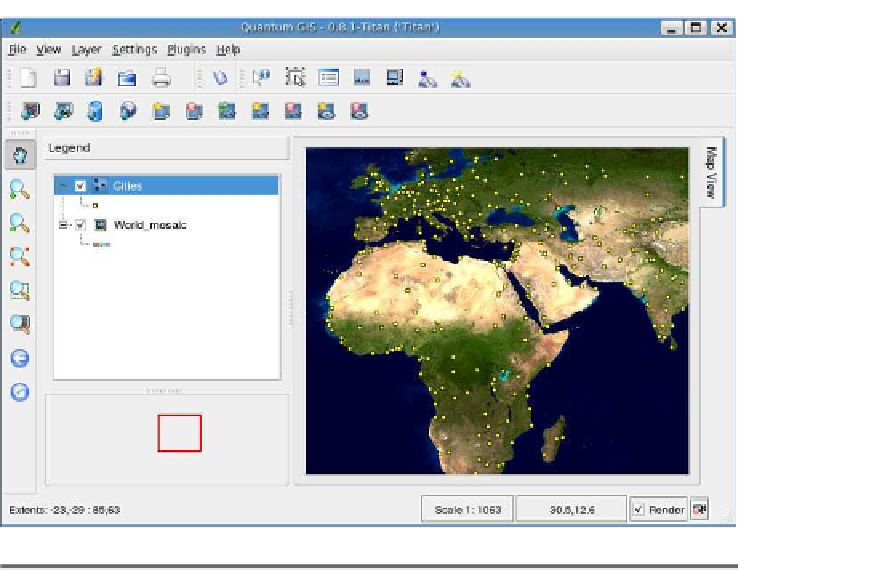
Figure 4.2: NASA world mosaic viewed in QGIS
The NASA raster is a georeferenced image in geographic coordinates,
meaning it can be used in conjunction with our world vector layers.
on top of the raster, just to prove they line up. Fortunately, both the
raster and vector data have geographic coordinates in the same datum.
In case you're wondering, a datum is a model of the shape of the earth
used to measure positions. In this case, the coordinates are in WGS
84, the same datum commonly used in modern GPS units. We'll take


Search WWH ::

Custom Search