Geography Reference
In-Depth Information
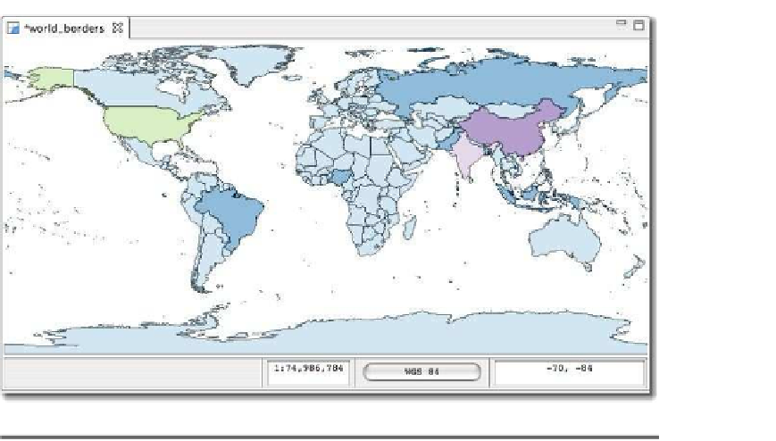
Figure 3.4: Countries classified by population
have suspected, China and India are rendered as the most populous,
followed by the United States. We could refine our classification to get
a finer-grained view of population by changing the number of classes
or the method. This is a common way to render data to make it tell a
story. Some of the other OSGIS applications we will look later offer even
more ways to symbolize your data.
3.3
Looking at Attribute Data
In the previous section, you might have wondered how we knew about
the
POP_CNTRY
field in the
world_borders
shapefile. Well, there are a num-
ber of ways to examine the attribute data associated with a layer. One of
the quickest ways is with
ogrinfo
, a utility that is part of the GDAL/OGR
suite. We'll take a more detailed look at
ogrinfo
and friends later in Sec-
on installing FWTools.
3
FWTools is a suite of tools that contains many applications, including
ogrinfo
.
3.


Search WWH ::

Custom Search