Geography Reference
In-Depth Information
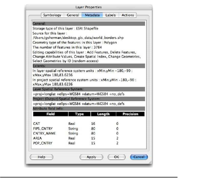
Figure D.1: Metadata for the
world_borders
layer
same in our example. This is because we haven't changed the coor-
dinate system of the map canvas. We are displaying the
world_borders
features in the same coordinate system in which they are stored.
The layer and project coordinate systems are displayed in the next sec-
tion of the metadata, using PROJ.4 format. In this case, it's
+proj=longlat
+ellps=WGS84 +datum=WGS84 +no_defs
. QGIS isn't so friendly in describ-
ing the projection in terms that we can easily understand. If you are
familiar with GIS and coordinate system, you can probably guess that
the coordinates are latitude and longitude in the WGS84 datum. Refer
on how to decipher what projection you're working with.


Search WWH ::

Custom Search