Geography Reference
In-Depth Information
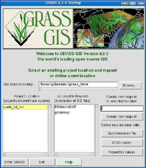
Figure C.6: GRASS GUI start-up screen
probably the quickest and easiest. If you are familiar with projections
and EPSG codes, you may find the other methods just as easy.
C.2
Getting Some Data
A GRASS location and mapset is nice, but you obviously need some
data to work with. GRASS uses its own format for storing data. Unlike
the OSGIS viewers we have discussed (Thuban, uDig, QGIS) that read
a number of formats, GRASS prefers its own format. That's not to say
you can't use external data with GRASS because you can. To get full
advantage of the capabilities, importing the data is required.


Search WWH ::

Custom Search