Geography Reference
In-Depth Information
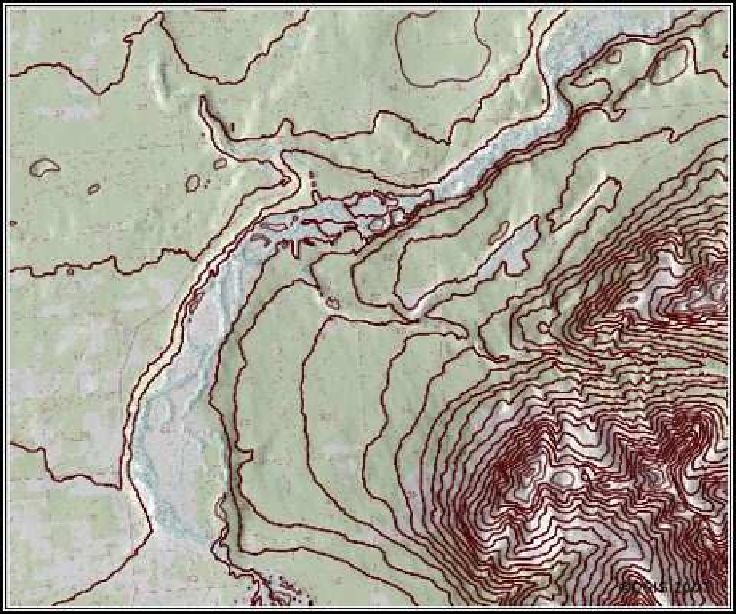
Figure 12.15: Result of contouring the DEM
to adjust the parameters to get the result you want. If so, you can use
the browser to delete the contour map and start over. Make sure you
remove the map from the QGIS canvas first!
In case you are wondering, we could of course accomplish the same
thing from the GRASS shell or command line. The command used to
create the contour map is as follows:
r.contour input="ancc6_drg@gsherman" output="ancc6_contour_200" \
minlevel=0 step=61 cut=0
The QGIS module leaves off a few parameters that we could have used
from the GRASS shell. (I know that we're talking about QGIS, but this
is good stuff.)


Search WWH ::

Custom Search