Geography Reference
In-Depth Information
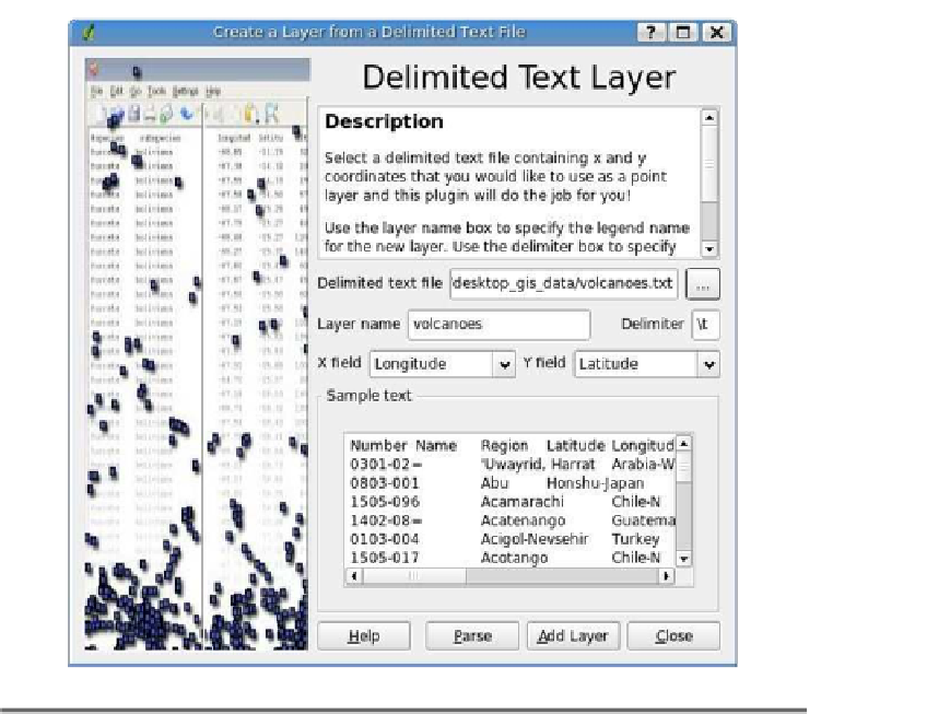
Figure 8.2: The QGIS Delimited Text plugin
and then use the Parse button. You can then choose the x and y fields
from the drop-down boxes.
Once you've added the text file to the map, you can use it just like any
other layer, including identifying features and viewing the attributes.
So far we haven't really imported anything. The Delimited Text plugin
includes a data provider that allows QGIS to treat the text file like a true
layer. Essentially a data provider acts as a translator between QGIS and
the data store, whether it be a text file, OGR layer, or PostGIS layer. If
you are happy with the text file, you can save it as a shapefile by right-
clicking the layer in the legend and choosing
Save as shapefile
. The next
time you want to use the data, just load the shapefile rather than going
through the text import process.


Search WWH ::

Custom Search