Geography Reference
In-Depth Information
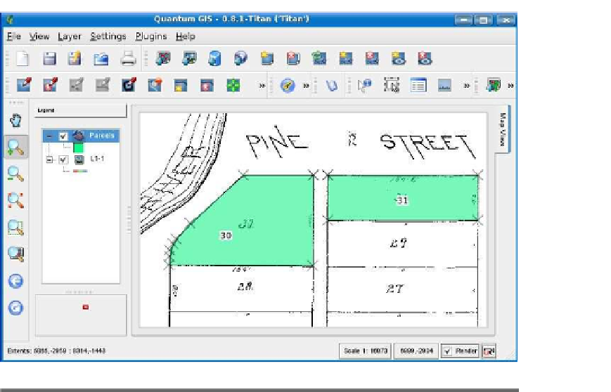
Figure 8.1: Digitizing a subdivision plat
with the availability of imagery and the ability to scan large documents
and maps into a format suitable for onscreen display.
As an example, we went out on the Internet and dug up an 1882 sub-
division plat from Wichita, Kansas. Our task is to create a vector layer
from the plat for use in historical archiving or some other creative pur-
pose. Of course, digitizing plats is an ongoing activity for government
entities. Our plat is a TIFF image and is not georeferenced. Since we
don't have any reference points to register it, we'll pretend it's in the
proper coordinate system. If we were doing this for real and wanted the
vector layer to overlay other city features, we would need to get it geo-
with the completed parcels shown in green. The plat itself is a black-
and-white scan of an original paper plat. We created a new shapefile
using QGIS and began digitizing the plat, storing the lot number for
each parcel in the attribute table as we go. When complete, this gives
us a new vector layer that contains the parcel number for each lot. This
in turn can be displayed with other vector layers in the same coordinate
system or linked by parcel ID to additional data in a database.


Search WWH ::

Custom Search