Geography Reference
In-Depth Information
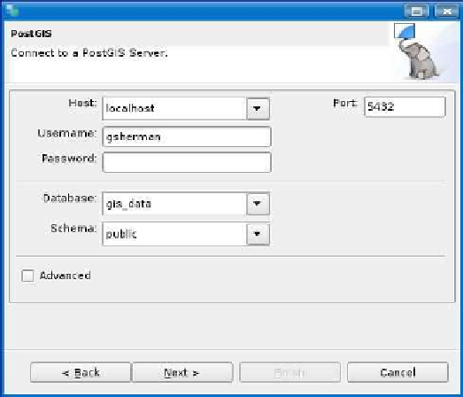
Figure 7.7: PostGIS connect dialog box in uDig
7.5
Using PostGIS and uDig
You can use uDig to display PostGIS layers—which is no surprise since
adding data to the map.
Adding a PostGIS layer is pretty easy—you just have to know the par-
ticulars of your database location and connection parameters, just as
tion dialog box with our connection parameters filled in. Once we click
Next, we are presented with a list of layers in the database that can be
added to the map. uDig doesn't currently support the filtering of Post-
GIS layers, so we can't create a “virtual” layer. Once the layer is added
Once you've made a connection, uDig keeps it available in the cata-
log, accessible at the bottom of catalog, accessible at the bottom of the


Search WWH ::

Custom Search