Geoscience Reference
In-Depth Information
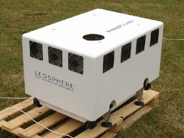
Fig. 3.11
Coherent Doppler wind LIDAR for wind energy assessment. The scanning infrared laser
beam is sent (and the backscatter is received) through the circular opening on the top side of the
instrument
Because of the sensitivity of coherent LIDAR systems, they can be made rel-
atively compact, yet maintain useful performance standards, including maximum
ranges (several kilometers to ~20 km), range resolution (less than 100 m), and veloc-
ity precision (a few 10's of cm s
−
1
). Such systems have a very narrow beam, which
allows sampling close to the Earth's surface, including near topography and build-
ings. Because of these capabilities, they are well suited for atmospheric boundary
layer applications (an example for such a device is shown in Fig.
3.11
). A special
scanning wind LIDAR for a height range between 40 and 200 m for wind energy
assessments is available since a few years (Wächter et al.
2009
).
Rayleigh Scattering: Incoherent Doppler LIDAR
An incoherent (or “direct detection”) Doppler LIDAR (Canin et al.
1989
)isan
alternative for the measurement of atmospheric wind speeds in air masses with
low or vanishing aerosol loads. These pulsed systems usually operate in the UV
and rely on contributions from both aerosol and the enhanced molecular (Rayleigh)
scattering at shorter wavelength to provide the return signal. A Fabry-Perot inter-
ferometer (Abreu et al.
1992
) can be used to analyse the Doppler shift of the
Rayleigh backscatter. While the capabilities of incoherent LIDAR are impressive
(they are being considered for space-based global wind measurements), their current
size, cost, and complexity suggest the technique is inappropriate for wind energy
applications considered here (Harris et al.
2006
).
Search WWH ::

Custom Search