Geoscience Reference
In-Depth Information
1986 MSS
1994 TM
1999 ETM
Parcel Boundaries
Forest
Secondary Forest
N
Transition
101
Crops
Pasture
Bare Soil
Water
Kilometers
Scale 1:75,000
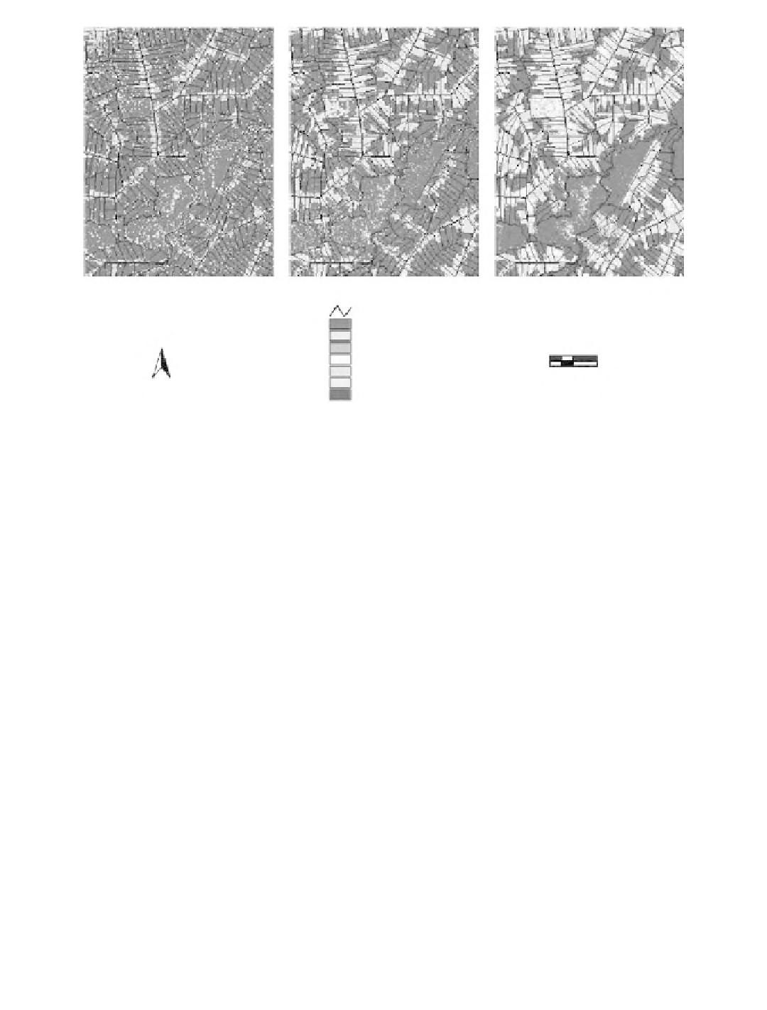
Plate 6.1
(See color insert following page 114.) Land-cover classification for three time periods between
1986 and 1999.
from economic, agronomic, and environmental perspectives, there is a need to link land-cover (LC)
change in Amazonia with more global externalities.
Rehabilitating the productivity of abandoned pasture lands has the potential to convert large
areas from sources to sinks of carbon (C) while providing for the well-being of people in the region
and preserving the world's largest undisturbed area of primary tropical rainforest (Fernandes et al.,
1997). Primary forests and actively growing secondary forests sequester more C, cycle nutrients
more efficiently, and support more biodiversity than abandoned pastures (Fearnside, 1996; Fearnside
and Guimaraes, 1996). Results from research on LU options for agriculture in Amazonia point to
agrosilvopastoral LU systems involving rotations of adapted crops, pasture species, and selected
trees as being particularly appropriate for settlers of western Amazonia (Sanchez and Benites, 1987;
Szott et al., 1991; Fernandes and Matos, 1995). Coupled with policies that encourage the sustain-
ability of these options and target LU intensifications, much of the vast western Amazonia could
be preserved in its natural state (Sanchez, 1987; Vosti et al., 2000).
Many studies have focused on characterizing the spatial extent, pattern, and dynamics of
deforestation in the region using various forms of remotely sensed data and analytical methods
(Boyd et al., 1996; Roberts et al., 1998; Alves et al., 1999; Peralta and Mather, 2000). Given the
importance of secondary forests for sequestering C, the focus of more recent investigations in the
region has been on developing spectral models and analytical techniques in remote sensing to
improve our ability to map these secondary forests and pastures in both space and time, primarily
in support of global C modeling (Lucas et al., 1993; Mausel et al., 1993; Foody et al., 1996;
Steininger, 1996; Asner et al., 1999; Kimes et al., 1999).
The need to better integrate the human and biophysical dimensions with the remote sensing of
LC change in the region has been reported extensively (Moran et al., 1994; Frohn et al., 1996;
Rignot et al., 1997; Liverman et al., 1998; Moran and Brondizio, 1998; Rindfuss and Stern, 1998;
Wood and Skole, 1998; McCracken et al., 1999; Vosti et al., 2000; http://www.uni-
bonn.de/ihdp/lucc/). Most investigations that integrate remote sensing, agroecological, or socioeco-