Geoscience Reference
In-Depth Information
y =
−
0.0024x
2
+ 2.8075x + 21.953
R
2
= 0.9812
800
Victorville/
Hesperia
Bakersfield
700
Lancaster/
Palmdale
600
500
Santa Clarita
Santa Barbara
400
300
200
Edwards
AFB
Ridgecrest
100
California City
0
0
50
100
150
200
250
300
350
400
TM Area km
2
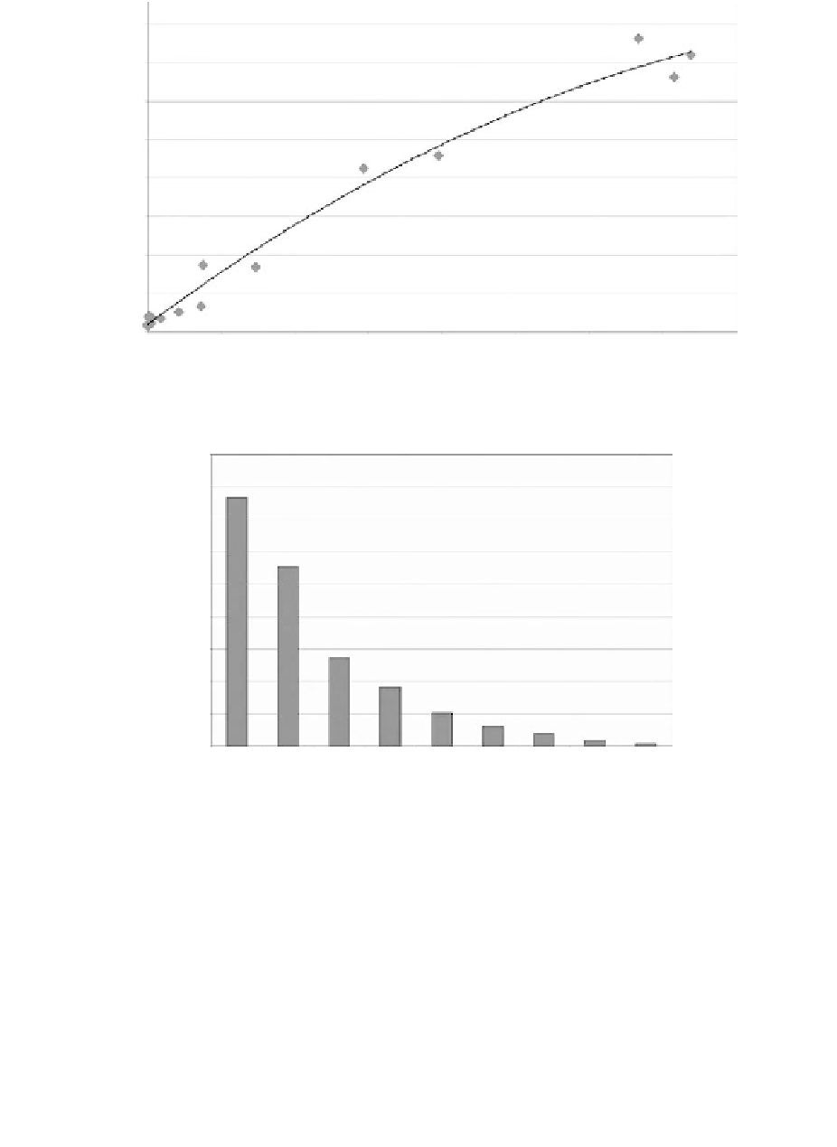
Figure 20.8
Area of OLS lighting vs. area of lighting estimated from Landsat 7 ETM
imagery.
+
45
40
35
30
25
20
15
10
5
0
1
2
3
4
5
6
7
8
9
Number of OLS Light Pixels
Figure 20.9
Multiplicity of OLS light detections from point sources of surface lighting.
oil and gas platforms. Based on preflight calibrations of the OLS, the oil and gas platforms produce
a top-of-atmosphere brightness of approximately 10
/sr.
Using isolated point sources of light we have tested the geolocation accuracy of nighttime lights
data from the four day-night DMSP satellites for which there is a digital archive. This includes
satellites F-10, F-12, F-14, and F-15. The OLS lights from single orbits have geolocation accuracies
ranging from 1.55 to 2.36 km. This was less than the GSD of the raw data (2.7 km). This subpixel
geolocation accuracy is achieved without use of ground control points. Being able to position lights
with comparable geolocation accuracy from the multiple satellites will be crucial to the analysis
of changes in the extent of development from the DMSP-OLS time series. While further testing
will be required, the geolocation accuracy results reported here are encouraging in terms of the
prospects for using nighttime OLS data to analyze changes in the extent of lighting over time.
-9
watts/cm
2