Geoscience Reference
In-Depth Information
Visible Band
PMT Shift Point
PMT Shift Point
Thermal Band
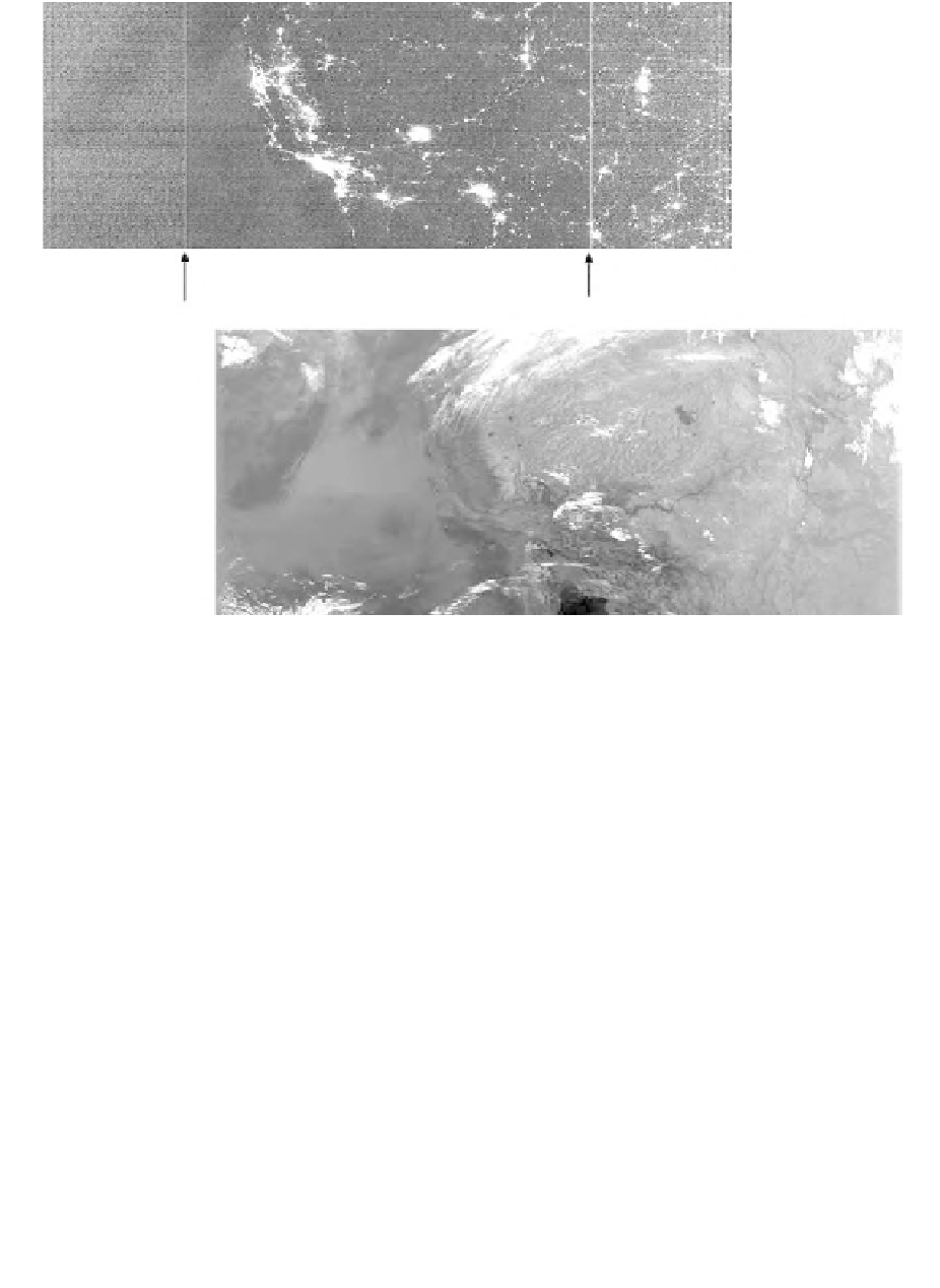
Figure 20.1
Visible and thermal NIR nighttime OLS images over California. With sunlight eliminated, the OLS's
light intensification results in the detection of lights present at the Earth's surface.
observed (Figure 20.1). The OLS visible band sensor system is designed to produce visually consistent
imagery of clouds at all scan angles for use by U.S. Air Force meteorologists with a minimal amount
of ground processing. The visible band base gain is computed on-board based on scene source
illumination predicted from solar elevation and lunar phase and elevation. This automatic gain setting
can be overridden or modified by commands transmitted from the ground. The automatic gain is
lowest when lunar illuminance is high. As lunar illuminance wanes, the gain gradually rises. The
highest visible gain settings occur when lunar illumination is absent. The combination of high gain
settings and low lunar illuminance provides for the best detection of faint light sources present at the
Earth's surface. The drawback of these high gain setting observations is that the visible band data of
city centers are typically saturated. Data acquired under a full moon when the gain is turned to a
lower level are generally not as useful for nighttime lights product generation since they exhibit fewer
lights and have the added complication of bright clouds and terrain features.
In addition to tracking lunar illuminance, gain changes occur within scan lines with the objective
of making visually consistent cloud imagery, regardless of scan angle. The base gain is modified
every 0.4 ms by an on-board along-scan-gain algorithm. A bidirectional reflectance distribution
function (BRDF) algorithm further adjusts the gain to reduce the appearance of specular reflectance
in the scan segment where the solar or lunar illumination angle approaches the observation angle.
The OLS design provides imagery with a constant ground-sample distance (GSD) both along-
and across-track. The along-track GSD is kept constant through a sinusoidal scan motion, which
keeps the track of the scan lines on the ground parallel. The analog-to-digital conversion within
individual scan lines is timed to keep the GSD constant from the nadir to the edge of scan. OLS
data can be acquired in two spatial resolution modes corresponding to fine-resolution data (0.5-km