Geoscience Reference
In-Depth Information
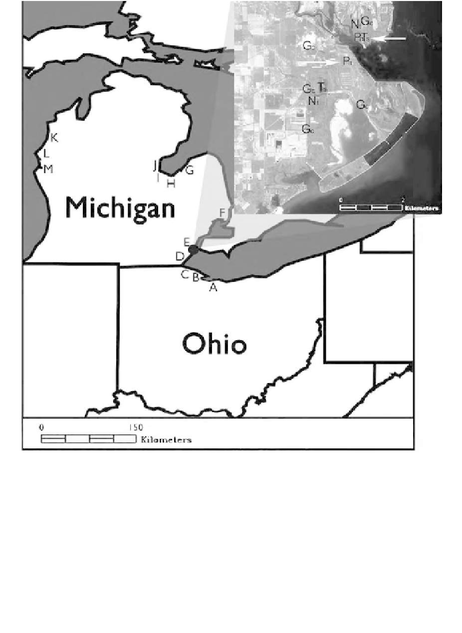
Figure 18.2
Thirteen wetland study sites in Ohio and Michigan coastal zone, lettered A-M. Sites were initially
sampled during July-August 2001. Inset image is magnified view of Pointe Mouillee wetland
complex (Site E). White arrows indicate general location of both field sampling sites for
Phragmites
(i.e., the northernmost stand and the southernmost stand). Field-sampled site location
legend: Pa =
australis
sp.; Nt = nontarget plant species; Gc = ground
control point. Inset image is a grayscale reproduction of false-color infrared IKONOS data acquired
in August 2001.
Phragmites australis
; Ts =
Typha
5 m, which is the
nominal spatial resolution of the PROBE-1 sensor. The ADAR system is a four-camera, multispec-
tral airborne sensor that acquires digital images in three visible and a single near-infrared band.
ADAR
(ADAR). The ADAR sensor enabled remote sensing of materials at the site of
<
data acquisition occurred on August 14, 2001, at an altitude of 1900 m above ground level
(AGL), providing an average pixel resolution of 75
¥
75 cm. Using ENVI software, a single ADAR
scene in the vicinity of the initial
Phragmites
sampling location was georeferenced corresponding