Geoscience Reference
In-Depth Information
1973
1986
1992
1997
Forest
Agriculture
Urban
Water
Grassland
Desertscrub
Riparian
Barren
Clouds ('92 and '97 only)
Land Cover
Legend
Oak Woodland
Mesquite Woodland
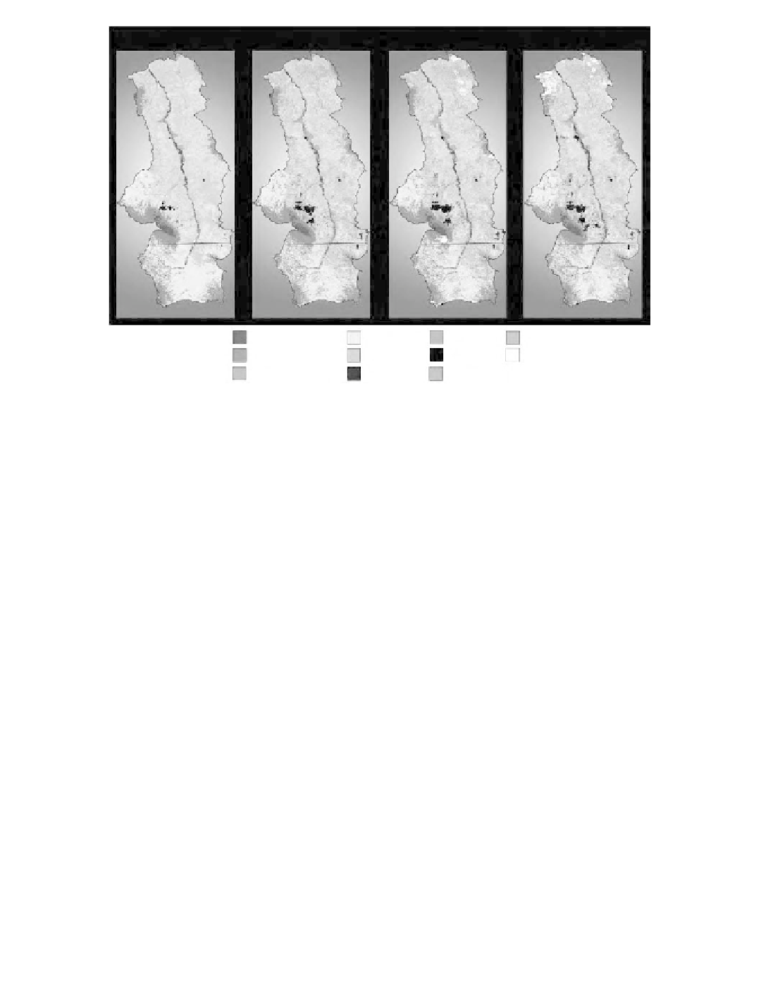
Plate 9.1
(See color insert following page 114.) 1973, 1986, 1992 and 1997 land-cover maps of the upper
San Pedro River watershed with key to classes.
Interactive manipulation of spectral signatures for each class permitted many of the mixed
classes to be resolved.
The remaining mixed classes were separated into different categories using
a variety of ancillary information sources, such as topographic maps produced by the Mexican
National Institute of Statistics, Geography and Information (INEGI) (1:50,000 scale) and the U.S.
Geological Survey (1:24,000 scale). The ancillary information used depended on the image being
analyzed; for example, classification of the 1992 image relied heavily on field visits to establish
ground control. Five 3-day site visits were conducted from September 1997 to June 1998 to enable
analysts to collect specific LC data with the aid of GPS equipment.
9.3.2
Sampling Design
Because available reference data only partially covered the study area, pixels within each map
were not equally likely to be selected for sampling; thus, a trade-off between practical constraints
and statistical rigor was necessary (Congalton and Green, 1999). Sample points were selected using
a stratified random sampling design, stratified by LC area for each of the four accuracy assessments.
Reference data covering the Mexican portion of the study area were not available. The number of
sample points was calculated using the following equation based on binomial probability theory
(Fitzpatrick-Lins, 1981):
2
Zpq
E
N
=
2
where
N
= number of samples,
p
= expected or calculated accuracy (%),
q
= 100 -
p
,
E
= allowable
error, and
= standard normal deviate for the 95% two-tail confidence level = 1.96.
For the lowest expected map accuracy of 60% with an allowable error of 5%, 369 sample points
were required. Under area-stratified sampling, rare classes of small total area (i.e., water and barren)
would not be sampled sufficiently to detect classification errors, so the minimum sample size was
Z