Geography Reference
In-Depth Information
Applied Geography: The September 11th
aftermath
In the aftermath of the terrorist attack on the World Trade Center, fires beneath the rubble
posed significant problems for relief and rescue workers. In addition to the smoke and
fumes, ongoing combustion progressively destabilized the huge debris piles in different
places, heightening the danger to people on the scene. Thus, it was a matter of some
importance to map the locations and intensity of “hot spots.” As a result, within 48 hours
of the incident, a special aerial survey was conducted that included thermal imaging. The
resulting data were used to produce maps that helped on-site commanders decide where
to concentrate and where not to concentrate their personnel and fire-fighting assets.
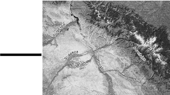
Satellite monitoring
Numerous satellites monitor and provide map-ready information about Earth's surface and atmo-
sphere.Virtuallyallofthemutilizenon-photographicscannersthatproducethermal,infrared,orradar
imagery. Data received by the scanners are stored onboard the satellite for later transmission to re-
ceiver stations on the ground. There the information is processed and assembled into photo-like im-
ages (see Figure 5-8).
Figure 5-8:
This
infrared image
shows the extent
of irrigated crop-
lands in a portion
of the America
West.
Getting Computerized
Todaynearlyallcartographyattheprofessionallevelisdoneonacomputer.Mapsinthisbookareex-
amples. Special kinds of software are available that allow cartographers to make maps with a degree