Geography Reference
In-Depth Information
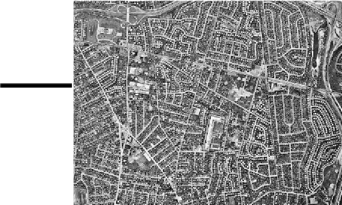
Aerial photography
Aerial photography
refers to photos of Earth's surface taken from aircraft. Today a majority of maps
produced under government approval at all levels, municipal through federal, are directly derived
from aerial photography. Black and white film has been a widely used medium (see Figure 5-7). In
addition to being inexpensive, it generally provides a clearer view of Earth's surface than does color
film, and therefore makes it easier to identify and map surface features.
Infrared photography
is also very popular. Infrared energy is contained in the sunlight that strikes the
Earth and reflects off its surface. You and I can't see it, but special kinds of films and sensors can.
Infrared energy readily passes through haze and air pollution, resulting in crisp images even on days
when the atmosphere is far from clean. Because of that very desirable characteristic, infrared photo-
graphy is widely used in aerial surveys.
Figure 5-7:
This
aerial photo-
graph shows a
suburban area
on Long Island,
New York.
The gray tones and colors on an infrared photograph may be very different than those observed on
regular black and white or color film. Because of that, the term
false color
is widely applied to in-
frared film and photographs. Most bizarrely, vegetation appears red. Indeed, the more lush or healthy
the vegetation, which appears downright green to you and me, the redder it appears on an infrared
photo. Infrared photos are capable of providing information that may not be apparent on normal color
or black and white photos. For example, differences in redness may indicate different kinds of crops
or forests, or indicate plant life that is stressed because of disease or drought.