Geography Reference
In-Depth Information
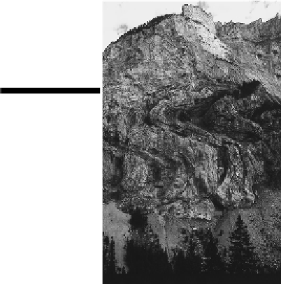
Figure 6-4:
A
photograph of
exposed folds in
a hillside.
Making resources accessible
The geography of mining often coincides with the geography of mountains because the tectonic pro-
cesses that make the mountains also serve to reveal the presence of valuable ores and minerals and
facilitate their accessibility to humans. The coal reserves of the Appalachians are a case in point.
In the diagram of folded mountains (see Figure 6-3), assume that coal occupies the second layer, or
strata
, of rock from the surface. In the flat terrain on the left of the diagram, one can see no indica-
tion of a valuable resource underfoot. On the right, however, folding may reveal the coal. If not, then
subsequent erosion — say, a river that “cuts through” the landscape — may reveal the presence of
valuable strata. This, in turn, may give rise to economic activity that — such as in the case of coal
mining in the Appalachians — is largely synonymous with the region.
Whose “fault” is it?
In addition to folding, head-on collisions of plates may also produce mountains by
faulting
. In
this case, a series of deep fractures develop through the crust. Over time, the immense pres-
sure attendant to the slow-motion collisions between plates may cause large-scale rock units
to be raised (producing
horsts
) or lowered (producing
grabens
) along the
fault lines
that mark