Geology Reference
In-Depth Information
well as identi
cation of local development projects for its
restoration, protection and cultural and economic develop-
ment. Moreover, this contribution aims to persuade not only
geologists, but decision makers that are responsible for land
policies and management about the importance of this geo-
logical heritage, and to consider the potentiality of the
Kerdous area to achieve the status of Geopark.
The Anti-Atlas marks the northern boundary of
the
Eburnian West African Craton (WAC) (Ennih and Li
geois
2001
; Thomas et al.
2004
) and is characterized by a local
display of the effects of the Neoproterozoic Pan-African
orogeny.
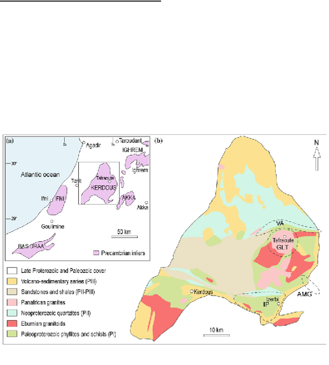
The Kerdous inlier, located at about 100 km SSE of
Agadir and with Tafraoute as the main town on its eastern
é
ank (Fig.
1
a), is one of the largest Precambrian inliers of
the Anti-Atlas belt. The area has been a subject of numerous
scienti
2
Geological Framework of the Kerdous
Inlier
cally to its geology (Chou-
bert and Faure-Muret
1972
; Hassenforder
1987
; Nachit et al.
1996
; Malek et al.
1998
; Thomas et al.
2004
; Soulaimani
and Piqu
c studies devoted speci
The NE-SW oriented Anti-Atlas belt is characterized by the
presence of several large Precambrian erosional windows
called inliers or
2004
; Gasquet et al.
2004
; Pons et al.
2006
;
among others).
As most other inliers of the Anti-Atlas, the Kerdous inlier
is formed by three main lithological units (Fig.
1
b): (1) A
Paleoproterozoic basement of crystalline metamorphic and
magmatic rocks, traditionally designated in the literature as
PI (Choubert
1963
; Choubert and Faure-Muret
1983
)oras
Eburnean. The metamorphic rocks, predominantly of sedi-
mentary origin (slates, phyllites, schists and migmatites) were
é
(Choubert
1963
). These in-
liers form a complex assemblage of basement rocks (Pa-
leoproterozoic, Neoproterozoic) rimmed by a cover of
Lower Paleozoic rocks (Gasquet et al.
2008
). The current
con
“
boutonni
è
res
”
guration where the Precambrian rocks are outcropping
within these inliers is due to the Alpine uplift of the Anti-
Atlas (Choubert
1963
; Cahen et al.
1984
).
Fig. 1
Location (
a
) and schematic geological map (
b
) of the Kerdous
inlier in the southern Anti-Atlas of Morocco, after Choubert (
1963
) and
Hassenforder (
1987
).
VA
Valley of the Ameln;
GLT
granitic landforms
of Tafraoute;
AMG
A
ï
t-Mansour gorges;
IP
Izerbi plain