Geology Reference
In-Depth Information
3.3
Arid-Humid Subtropical-Semihumid
Temperate Karst Landform Region (III)
extending from Qinling to the Eastern Anemaqen Mountain,
turning to the south to Yulong Mountain, then to the Eastern
Himalayas to the west. There are very different geomor-
phologic types in this region, consisting of the Sichuan
Basin and the Yunnan-Guizhou Plateau as well as middle-
high mountains around to the west, with elevations of
1,500
The northern boundary of the arid-humid subtropical-semi-
humid temperate karst landform region is from Shandong
Peninsula along the Yellow River to Qinling Mountains. It
borders Region II in the south. This region consists of the
Huaihe River drainage area and a small part of the Yellow
River Basin, and features higher topography in the west, and
hilly area to the east, slightly tilting to Huanghuai plain in
the southeast. The region is located in humid northern sub-
tropical-southern temperate climate, with average annual
temperature of 12
2,000 m or more (excluding the Sichuan Basin),
while in the east they are less than 1,000 m ASL. This karst
region occurs essentially in a humid subtropical climate
except in the border area to the south. Its average annual
temperature is 15
-
19
°
C and its annual precipitation is
-
1,000
1,400 mm.
This karst region is mainly situated in the Yangtze Plat-
form to the east and Himalayan block to the west, and is
underlain by carbonates >10,000 m in total thickness with
ages from the Cambrian to the Triassic. There is an almost
continuous carbonate outcrop of 500,000 km
2
(Li et al.
1983
) where karst landforms are well-developed (Gao et al.
1986
; Zhu et al.
1988
) (Figs.
2
,
3
and
4
). Thirty-one national
karst geoparks are established in this region. More than 90 %
of fengcong (cone karst) and all fenglin (tower karst) are
distributed in this region, except to the north of Region I and
to the southeast of Region VI in southwestern Sichuan and
in northwestern Yunnan, with areas of 134,500 and
101,000 km
2
respectively (Li et al.
1983
). In addition, the
semi-karst is well distributed and is characterised by differ-
ent formations of hilly karst, valleys and plains, with a total
area of 56,800 km
2
.
-
-
15
°
C and annual precipitation of
700
900 mm. The arid-humid subtropical-semihumid tem-
perate karst landform region is located among the North
China platform and the Yangtze platform, and the eastern
extension of the Kunlun-Qinling-fault and fold belt. The
carbonate rocks that underlie it are mainly late mid-Prote-
rozoic to Early Paleozoic in age, some 927 m thick at most.
Two national karst geoparks are established in this region.
After the Cenozoic period, continental sediments of
>6,000 m thickness were deposited as a result of the
decrease in tectonism, and most of the karst features were
buried by the sediments of the plain. As such, the karst in
this region is well buried. At the same time, the areas in
central-southern Shandong and western part were uplifted by
fault movement, and about 1,000 km
2
area of karst was
exposed to form karst mountains and hills (especially the
-
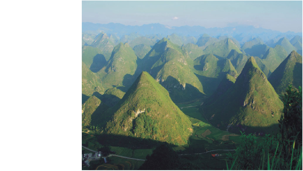
Fig. 2
Region II karst landform
(fengcong karst in Guangxi by Li
Jin)