Geology Reference
In-Depth Information
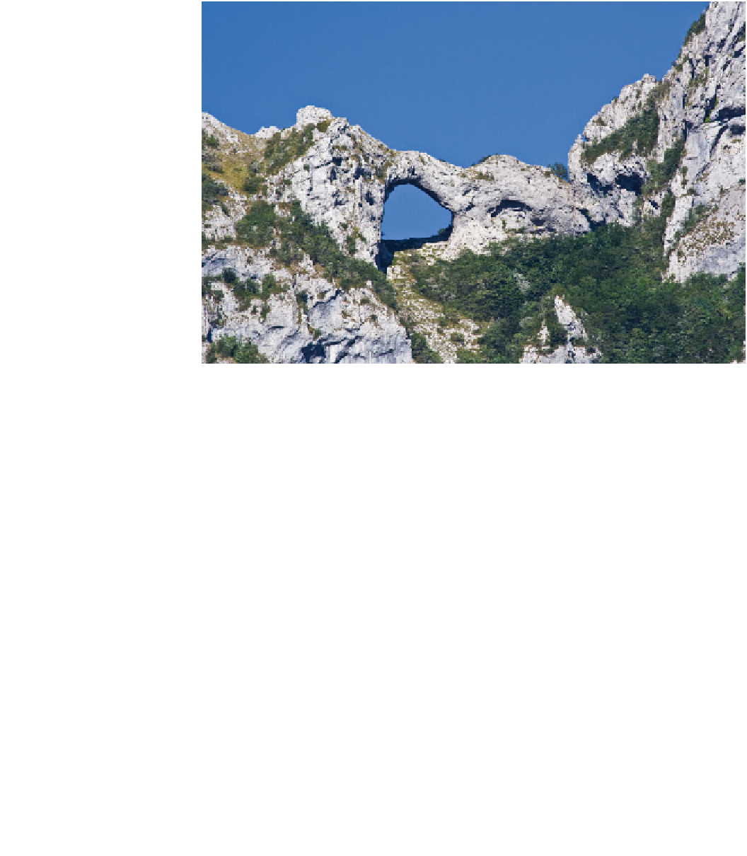
Fig. 10
Natural arch of Mt.
Forato in the southern Apuan
Alps Geopark (see location in
Fig.
4
) (photo by Paola Fazzi)
Another geosite of global interest is the Buca della Vena
Mine (Stazzema) in the mining area of the central-southern
Apuan Alps (Fig.
4
), well known to the world community of
mineralogists for its very rare mineral parageneses. During
the last 20 years, more than 80 mineralogical species have
been identi
rst time, namely alla-
nite-(La), apuanite, dessauite, marruciite, pellouxite, pillaite,
rouxelite, scainiite (Fig.
9
), stibivanite-2O, and versiliaite
(Orlandi and Dini
2010
). For the most part, these minerals
have not been identi
ed, ten of these for the
ed elsewhere in the world.
5.1.2 Geosites of National Importance
The records of Apuan geosites identi
ed as being of
national interest are considerably larger. This category
includes hypogean karst systems whose dimensions are
smaller than those of international status mentioned in the
preceding section. However, the inventory includes sites
with geomorphological features and others linked to glacial
processes. Mt. Forato, a natural arch 26 m high and 32 m
wide (Fig.
10
) provides a good example of the former, and
there are also elements in carbonate rocks, typical of the
landscape in the Dolomites region of Italy, such as towers,
aiguilles and pinnacles (Fig.
11
). Sites linked to glacial
processes are restricted to W
ü
rmian moraine deposits and
Fig. 11
Aiguilles and pinnacles of Mt. Procinto group in the southern
Apuan Alps Geopark (see location in Fig.
4
)
pre-W
rmian cemented deposits and are preserved only in a
few sites (Equi Gorge, Vestito Pass, Terreno Valley) (Bra-
schi et al.
1986
). The Apuan Alps, however, retain wide-
spread evidence of landforms indicative of glacial erosion
and deposition (Braschi et al.
1986
; Federici
2010
)
(Fig.
12
).
The potholes occurring along Fatonero and Anguillaja
streams, on the southern
ü
grouped in a geosite of national interest for their unique
dimension (diameter more than 6 m), and regular circular
form and concentration (Fig.
13
). The formation of the
potholes has been interpreted as a consequence of water
forced through subglacial galleries developed under the
glaciers of the last Glaciation (Amor
ank of Mt. Sumbra, have been
ni and Isola
2010
).