Geology Reference
In-Depth Information
1
Introduction
visitors. In spite of the economic potential of the volcanoes,
serious geoheritage studies have not yet been carried out
along the CL. Among these volcanoes, Mount Manengouba
has been selected for this study. It is characterized by an
equatorial climate of the Guinean type, dominated by about
7 months of precipitation in June
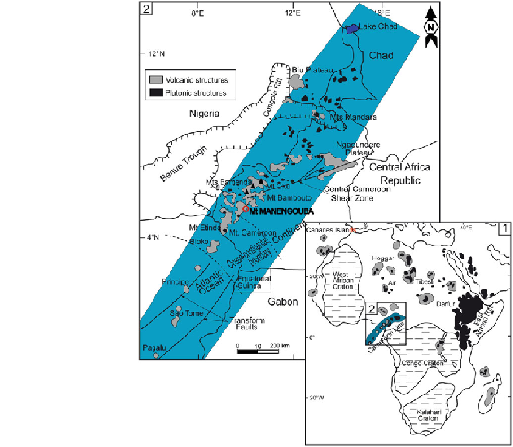
Cameroon is crossed by a structure called Cameroon Line
(CL), which is an oceano-continental axis, comprised of
volcanic and plutonic rocks (Fig.
1
). It is oriented N30
E and
stretches from Gulf of Guinea to Lake Chad (Tchoua
1974
).
Although there is sporadic occurrence of natural phenomena
(Kling et al.
1987
; Sigurdsson et al.
1987
; Nana
1991
; Evans
et al.
1993
; Tanyileke
1994
; Wandji et al.
1994
,
1998
,
2001
;
Tchoua et al.
1998
,
2001
; Njilah et al.
1999
; Bardintzeff
et al.
2001
; Ghogomu et al.
2001
; Kagou Dongmo et al.
2005
; Zangmo Tefogoum et al.
2009
,
2011a
,
2012a
; Nechia
Wantim et al.
2012
), these structures represent numerous
assets for educational and cost-effective activities. Thus,
multi-ethnic populations migrated there; moreover, it is an
attraction for national and international researchers, and
°
October (with an average
of 2,742 mm/year) and a dry season of 5 months
-
'
duration,
with temperatures ranging from 21 to 24
C (Olivry
1986
).
Mt Manengouba constitutes a geological heritage dominated
by numerous geomorphological features.
The objective of this paper is to identify and study the
potential geomorphosites of the Mt Manengouba, this will
give an overview on: (1) the touristic potential of the studied
area; and (2) impacts of the geomorphosites on farming,
breeding, hunting (main income sources for local inhabit-
ants), and educational activities. This will be an important
°
Fig. 1
Cameroon Line (CL) in
Africa (
1
); location of Mt
Manengouba in the CL (
2
) (from
Nkouathio et al.
2008
, modi
ed)