Geology Reference
In-Depth Information
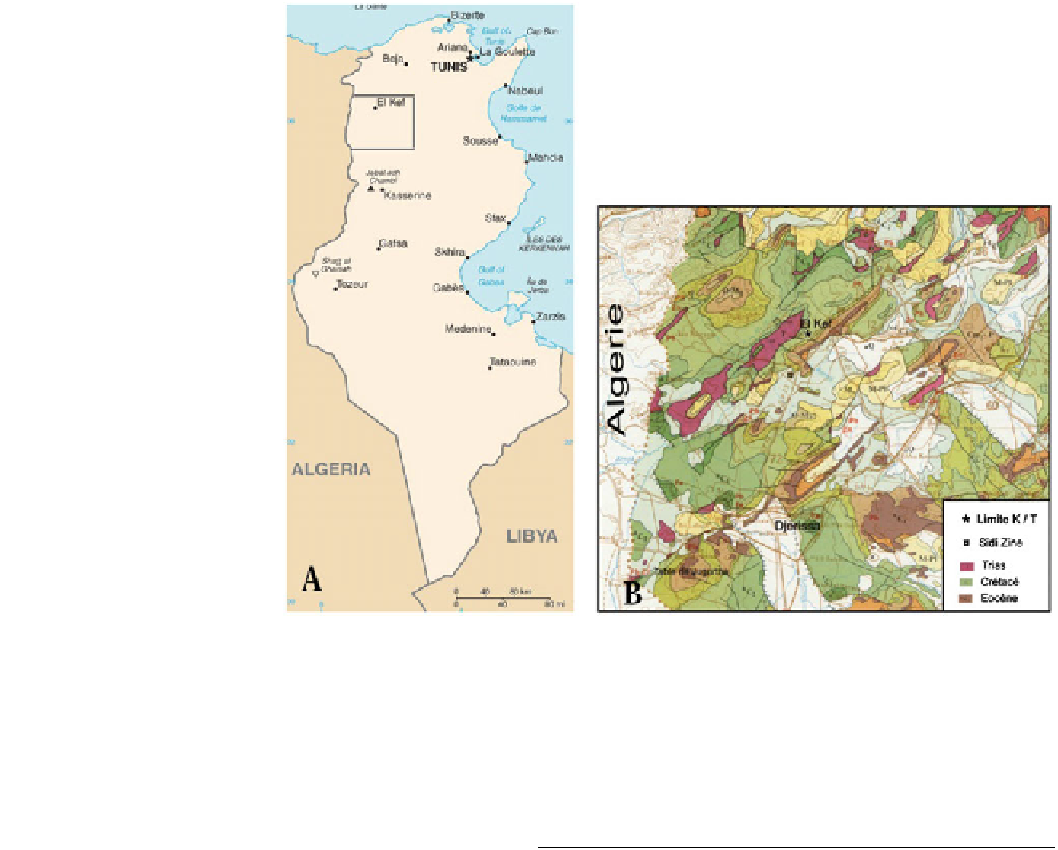
Fig. 1 a
Geographical location
of Tunisia and position of El Kef
area.
b
Geological map (detail of
Fig.
1
a) (From geological map of
Tunisia at 1/500,000)
Tunisian Atlas, and an area of
at and tabular landscapes in
the south, characterized by the superposition of the very
fossiliferous Mesozoic and Cenozoic formations (Fig.
1
b).
The oldest deposits exposed in the area are the Mesozoic
formations, with the Jurassic and a part of the Lower Cre-
taceous missing. The stratigraphic series is marked by the
preponderance of the upper Cretaceous and Palaeogene,
mainly in the western part of El Kef area.
The region includes the largest mining area in central
western Tunisia. It is rich in iron, lead and zinc. It contains
the largest iron-ore
fl
sites. It also offers opportunities for collaboration with
national and international university teams. This museum
will also provide information on water resources, thermal and
mineral water as well as mining resources (Fe, Pb, Zn) and
other useful materials.
3
Geosites Description
The preliminary inventory allowed us to choose 8 geosites to
be described in this paper (Fig.
2
). The choice was based on
their scienti
eld in the country, i.e., Jebel Jerissa. It
is also known for its hot springs, two of which are noted for
their therapeutic values. The most famous of these springs is
Hammam Mellegue which is a traditional public bath, once
used by the Romans as evidenced by the remains of the old
thermal baths.
The region has a unique human heritage which includes
the famous Palaeolithic site of Sidi Zine and the Neolithic
site of Jebel Sidi Mansour where paintings depict early
human settlement.
El Kef governorate has long been known for its palae-
ontology. A museum planned for the future to be called
“
c and cultural importance (Table
1
).
3.1
Triassic Formations of Koudiat El Mrira
(G1, Fig.
2
)
On the right bank of Oued Mellegue, the Triassic-deposits of
Koudiat El Mrira comprise clay-gypsum and calcareous
sandstone with two spilitic diabase
ows that are accompa-
nied by subaqueous projections (pillow lavas or tuffs). This
stratigraphic sequence is dominated by evaporites, cropping
out in the core of the anticlinal structures as diapers or as
blades along SW-NE orientations. The geosite consists of
yellow dolomite, lamellar and saccharoidal gypsum, with
bipyramidal quartz crystals, pyrite dodecahedrons and dolo-
mitic rhomboids. These yellowish dolomites have yielded
fl
will exhibit a wide variety of rocks,
minerals and fossils described or collected from geological
sites in the region. It provides an opportunity for continuing
research because the region has numerous fossil deposits of
vertebrate and other fossils and contains many archaeological
Memory of Earth
”