Geology Reference
In-Depth Information
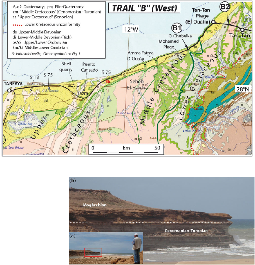
Fig. 11
Route and geosites location of the western part of geotrail
“
B
”
, plotted on the Geological map of Morocco (Hollard et al.
1985
)
Fig. 12 a
Oued Chebeika
estuary,
b
zoom on the cliffs of
the west border of the estuary
planktonic marls or chalks rich in organic matter (bituminous
marls), alternating with limestones dominated by coccoliths,
benthic foraminifers and pellets (El Albani et al.
1999
;
L
upwelling phenomena along the Atlantic coast. These bitu-
minous marls are potential petroleum source rocks (Sachse
et al.
2010
) and could be also exploited as
(cf. the
pilot quarry that was excavated west of Tazra; Rjimati et al.
2011b
). The whole region has been intensely explored in the
last decades for oil and gas. A 4 km deep industrial well was
drilled at Tazra as early as the 1960s (Puerto Cansado well;
Choubert et al.
1966
), and many other wells have been dril-
led, both onshore and offshore (Ha
“
oil shales
”
ning et al.
2004
; Mort et al.
2008
). They have been
deposited in the external platform domain that became pro-
gressively deeper (Gebhardt et al.
2004
) with dominant
anoxic conditions of sedimentation (Keller et al.
2008
). Their
regular depositional rhythms have been ascribed to orbital
forcing (Kuhnt et al.
1997
), whereas their
ü
remarkable
d et al.
2008
). Drillings
have demonstrated the occurrence of Triassic and Jurassic
organic-matter
richness
(Kolonic et al.
2005
)
records