Geology Reference
In-Depth Information
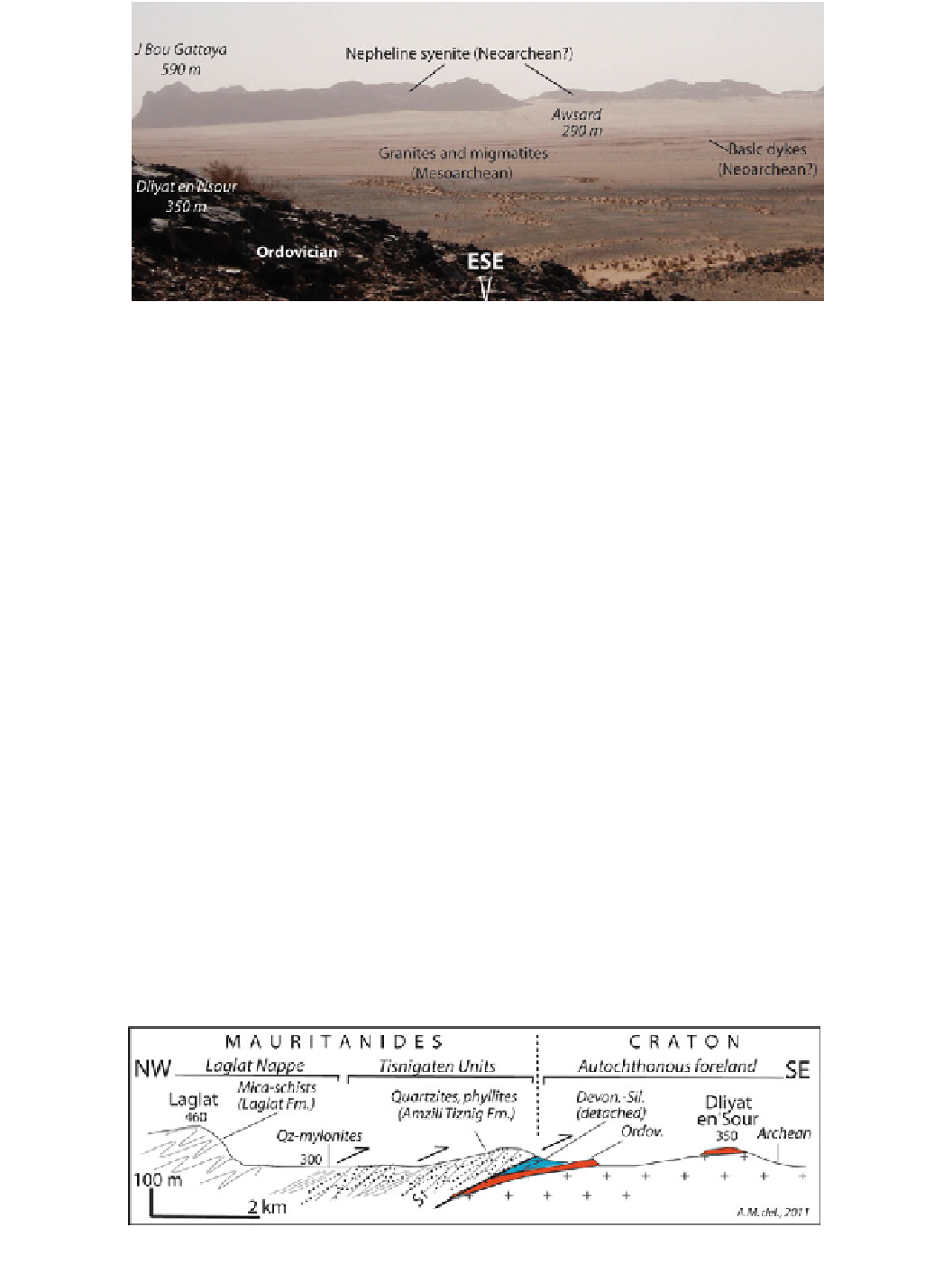
Fig. 9
Awsard panorama as seen from the Dliyat En
'
Sour Ordovician ridge
quartzites most likely deposited after the dramatic erosion
linked to the northward progression of the Hirnantian in-
landsis, which capped the Saharan regions at that time
(Deynoux et al.
1985
). Last, but not least, looking to the west
provides a large overview of the frontal units of the Maurit-
anide thrust nappes, i.e., the Tisnigaten metaquartzites
(Neoproterozoic?), the Laglat mica-schists (Archaean me-
tasediments) and overlying Derraman orthogneisses
(Archaean metagranites). It can be noted that Silurian pelites
and Devonian limestones are mapped (Fig.
7
) between the
Ordovician quartzites and the nappes north and south of the
Dakhla road transect. The cross-section below (Fig.
10
)
summarizes the structure of the front of the Variscan nappes,
which is an unusual system of thin basement slivers thrust
directly, or almost directly, on top of the Archaean crust.
Finally,
geosite A10
is located within the Laglat hill
(Fig.
7
) at short distance from the main road, close to a quiet
“
northern Mauritania close to the Moroccan border (Le Goff
et al.
2001
).
3.2
El Ouatia
-
Tan-Tan
-
Mseied Geotrail
This second geotrail is located about 700 km north of the
Dakhla-Awsard transect (Fig.
2
) and provides the opportu-
nity to view new and contrasting themes: (i) in the western
part of the geotrail, close to the El Ouatia sea-side resort, the
outcrops show the Cretaceous-Miocene formations of the
Atlantic Coastal basin (Tarfaya-Boujdour basin); and (ii) in
the eastern part of the geotrail, i.e., from Tan-Tan to Mseied,
the outcrops belong to the continental basement and expose
the Late Precambrian-Early Carboniferous formations of the
southernmost part of the Anti-Atlas belt.
3.2.1 Passive Margin and Atlantic Coastal Basin
Around El Ouatia
Starting from El Ouatia to the southwest, a few tens of
kilometres along the main road (N1), the
(holy memorial) in the centre of a silent rocky
cirque. The cliffs expose mica-schists most likely of
Archaean age (Rjimati and Zemmouri
2002
) that show
superimposed penetrative structures (Fig.
8
d). The youngest
kinematic indicators point to a dominant top-to-the-east
shearing linked to the post-Devonian (Variscan) emplace-
ment of the Mauritanide nappes. The Variscan metamor-
phism that affects these nappes has been dated at 333
zaouia
”
rst geosite (
geosite
B1
) of the trail can be reached (Fig.
11
). This geosite is
located in the Oued Chebeika estuary, which widely exposes
Upper Cretaceous formations typical of the Tarfaya Basin,
otherwise concealed under the Moghrebian calcarenites and
sands (Fig.
12
). These Cenomanian-Turonian beds consist of
±
25/
325
±
43 Ma (Early Carboniferous) in metagabbros from
Fig. 10
Cross-section of the front of the Mauritanide nappes in the Awsard area, after Michard et al. (
2010
). See Fig.
6
for location