Geography Reference
In-Depth Information
hitchers pass from player to player, phone to phone and cell to cell, gathering information
and encouraging players to label cells with meaningful place names.
During its runtime, the game builds up a collection of unique cell IDs and transitions
between cell IDs. These unique cell IDs also have location labels given to them by one or
more players. From this we are able to build up a connected graph whose nodes represent
unique cell IDs and whose arcs represent direct transitions between pairs of cell IDs. This
graph is visualized using a well-known force-directed placement algorithm (Fruchterman
and Reingold, 1991) that is implemented in the JGraph library (Java Graph Library, 2007).
Consequently, this is an abstract graph and the relative positions of the nodes bear no relation
to geographical directions in the physical world.
As we have mentioned above, cell IDs can provide an alternative way of mapping partic-
ipants' movements where more accurate location tracking techniques are not available. In
this example, using this cell ID graph and location labels has enabled exploration of potential
mappings between clusters and patterns of mapped cells and user-meaningful places and
activities.
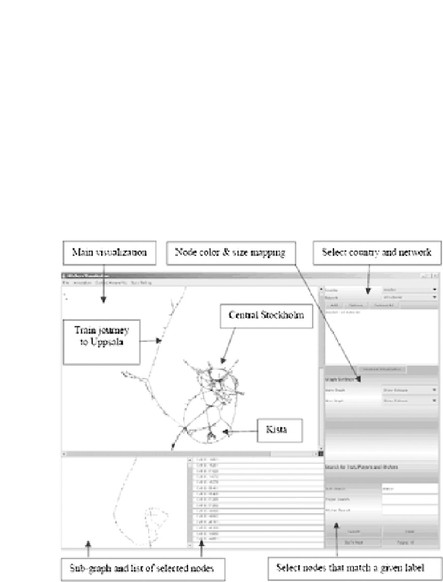
For example, Figure 16.1 shows how the data gathered from a Hitchers trial in Sweden is
visualized in the Hitchers visualization tool. The figure reveals some distinctive clusters of
Figure 16.1
The Hitchers cell-data visualization tool


Search WWH ::

Custom Search