Geography Reference
In-Depth Information
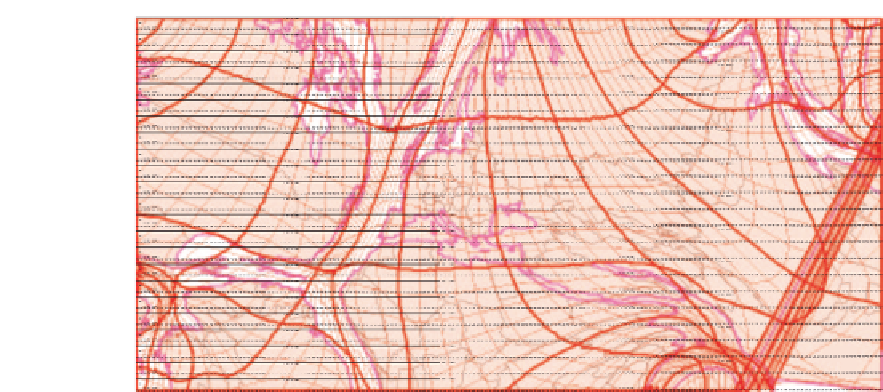
Figure 8.4
Multiple layers projected onto a high-resolution SOM (125 000 neurons) trained with
geographic coordinates (from Skupin, 2003)
low-dimensional, SOM can be quite fast. An extreme example is probably the projection of
geographic coordinates (without consideration of any other attributes) into a SOM space
consisting of 125 000 neurons (Skupin, 2003), which took 48 hours on an 800 MHz Pentium
III PC and resulted on an odd new form of map projection (Figure 8.4). Note that there are
many more factors influencing the speed of SOM training, including the number of training
cycles and the specific SOM algorithm used (e.g. the later stages of training for the patent
SOM used a variation known as the
Batch Map
).
8.3.3 Proposition
The core idea advocated in this chapter is to use the SOM method to project geographic
objects into a finely grained display space in order to provide a different, yet equally rich
and holistic, perspective on geographic phenomena than that provided in traditional map
space. While the latter is based on location given in geographic coordinates, the former will
be constructed from the objects' attributes.
When dealing with non-georeferenced data, such as text documents, a high-resolution
spatialization can become the centre of a visualization system because it is often the first and
only such visual depiction and has the potential for becoming the central access mechanism
for complex data and, with widespread acceptance, even developing iconic and reference
status for a large user group, for example in the visualization of scientific knowledge domains
(Shiffrin and Borner, 2004). This is different for georeferenced data, where the geographic
map naturally maintains a central role, owing to the already discussed spatial autocorrelation
effects. However, a detailed visualization derived from just the non-spatial attributes can
provide an alternative perspective on geographic phenomena. This point is driven home
by another aspect of our proposal, which is to juxtapose geographic and attribute space
depictions while deliberately applying uniform designs and thus allowing the data to 'speak'
about commonalities and differences between the two visualizations.


Search WWH ::

Custom Search