Geography Reference
In-Depth Information
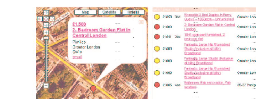
Figure 7.5
An example of an aerial photograph linked to a property listings website, October 2006
(source: author screenshot from www.housingmaps.com)
to construct these images tends to include data on property prices, geodemographic pro-
files, crime rates, local taxation rates, accessibility measures to local amenities and services
and the educational standard of local schools. These statistical 'images' of neighbourhoods
are becoming enhanced and contextualized by high-resolution aerial photographic images,
allowing people to 'see' what the data are describing. IBNIS are often linked to real estate
websites which in turn provide information on individual properties for sale or rent in the
neighbourhood (Figure 7.5).
With IBNIS and real estate websites, the search costs are lowered and more properties
can be considered. The information on potential properties is now filtered through search
engines and internet portals and buyers and renters can make decisions as to whether to view
a property after analysing on-line property details and IBNIS data including external images
of the property from high-resolution aerial photographs. These photographic images can
help indicate the 'status' of a street or neighbourhood by revealing makes of car parked in
driveways, the presence of swimming pools in back gardens, the density of development,
the amount of greenery/vegetation in the street or neighbourhood, the general quality of
the street environment, the indication of children living in the immediate neighbourhood
(e.g. by play equipment in the garden, which may be deter some people, such as elderly
buyers), the quality of neighbouring houses and the state of neighbouring gardens, etc. These
characteristics can be very influential for a potential buyer/renter and cannot be gained solely
from statistical data provided by IBNIS or a real estate agent. The result in this lowering of
search costs and the availability of information on property and neighbourhood may mean
that members of the public will be motivated 'to sort themselves out' (Burrows, Ellison and
Woods, 2005, p. 36) within the housing market to a greater degree than has happened before.
7.4 Conclusion
The chapter has provided a broad overview of some of the visualization applications of aerial
photography in planning with reference to property-related research. Although it is an old
tool, aerial photography is experiencing a resurgence of interest in planning and beyond,


Search WWH ::

Custom Search