Geography Reference
In-Depth Information
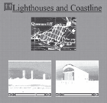
(a)
(b)
Figure 6.10
The Theatre metaphor resources
6.4 Townsville GeoKnowledge Project
The prototype was designed to be delivered via a Web browser with minimal plug-ins - for
Flash
and
QuickTime
movies. As part of the package, users can undertake a 'surrogate walk'
around the city. Once the user 'clicks' on one of the hot spots they are presented with a
choice of images of the city, initially through a map interface (Figure 6.11) and then with a
more detailed street intersection photograph collection (Figure 6.12). As well as individual
images, users are also provided with a number of panoramas that were taken at key sites
that overlooked the city. An example of a panorama is shown in Figure 6.13.
At each street intersection the user is provided with a choice to continue walking in the
same direction, turn left or right or go back the way they came. The map to the right of
the screen (Figure 6.14) 'keeps pace' with the user and indicates both the position and the
direction of observation. If extra information, photographs or access to further information
in the package is possible, information icons appear on the photograph. By clicking on the
icon the user can access these supplementary information resources.
Whilst the user 'walks' along streets where additional information like panoramas, extra
building photographs, etc. are available, icons indicate where these can be accessed. The
access icons are shown in the photograph in Figure 6.15. Figure 6.16 shows how additional
photography is provided.
6.5 Jewell Area prototype
As part of a research programme to develop and test web-delivered tools to support com-
munity collaborative decision-making, an interactive three-dimensional tool was developed
using the Virtual Reality Modelling Language (VRML). It was designed to be delivered via
the Web, and to be used at home or at Internet cafes located in the application area, and


Search WWH ::

Custom Search