Geography Reference
In-Depth Information
Figure 6.6
Large-scale aerial photograph of the northern part of Queenscliff
Once the user moves to the larger scale aerial photograph (Figure 6.6) the directional
arrows can again be used to move from block to block. A move to the cadastral maps, invoked
by clicking the 'Cadastral' icon, provides the user with a screen image of the cadastral section
relating to the same area as that covered in the aerial photograph. The 'up' button allows
for the smaller-scale photographs to be viewed, if an overview of the photograph coverage
is required.
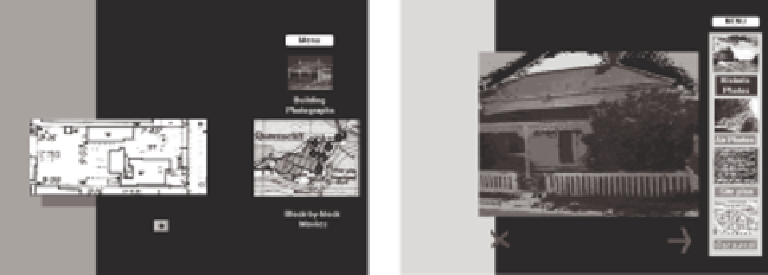
A site plan of each of the historical houses is also provided. The user has several options:
to move from site plan to site plan using the directional arrows at the bottom of the plan; to
go to the collection of building photographs; to view block-by-block movies (by clicking the
appropriate dot on the map); or to return to the menu. Figure 6.7 illustrates the information
available for individual building information. The 'clickable' icons, photographs, text and
map 'hot spots' lead to more building plans, house photographs and videos of block-by-
block streetscape footage.
Figure 6.7
Individual house information


Search WWH ::

Custom Search