Geography Reference
In-Depth Information
2.2.2
The Third Grade (8-9 Years Old)
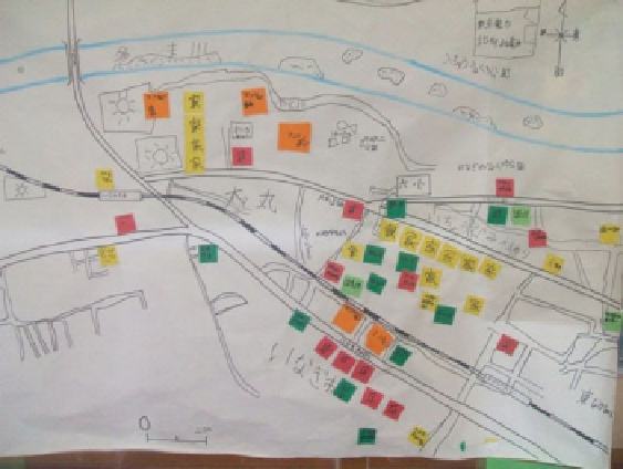
Students usually learn to read and draw maps of the neighboring area at the beginning
of third grade, that is, during the spring term. They begin by laying out pictures of
buildings, trees, shops, and other objects on large sheets of paper spread out on their
desks (Fig.
2.2
). These activities allow them to consolidate their knowledge of their
own neighborhoods. They learn about the spatial arrangement of places in their sur-
rounding environment by making illustrated maps. Thus, students can develop their
environmental perception and cognitive abilities (Yoshida
2008
).
Eventually, study areas are extended to the town where the students live. They study
landforms, land use, road and railroad patterns, shopping street, and factory locations.
They compare land use and landscapes to other parts of town with a different physical
environment. They read not only illustrated maps but also other general maps. Vertical
aerial photographs can be used to help students read maps.
1
2.2.3
The Fourth Grade (9-10 Years Old)
Students conduct fi eldwork to observe fi rsthand the location and function of a fi re
station or police offi ce. Before leaving their classrooms, they verify on a map the
route from the school to their destination.
Fig. 2.2
Neighborhood map made by students
1
The National Curriculum Standards' objectives for the third and fourth grades are combined.
However, a separate syllabus is planned for each grade.