Geography Reference
In-Depth Information
60°
40°
40°
40
ATLANTIC
OCEAN
Tropic of Cancer
40
20°
20°
20°
PACIFIC
Equator
0°
OCEAN
80
20°
20°
20°
Tropic of Capricorn
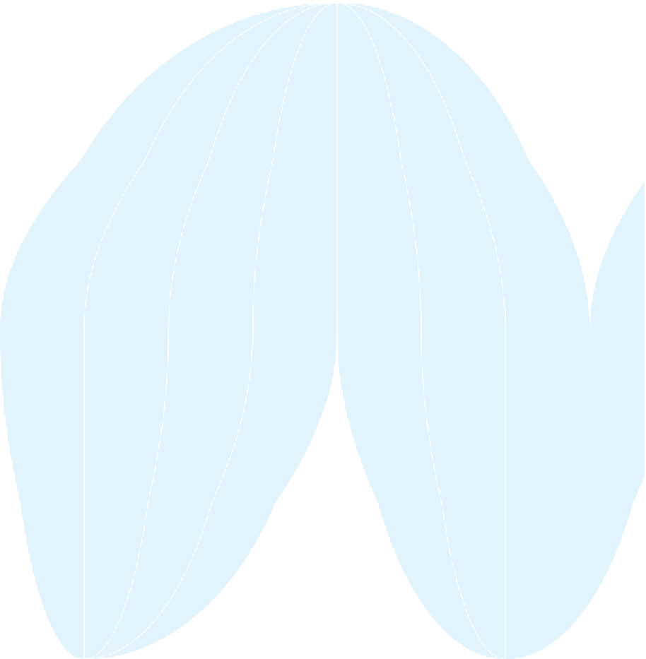
AVERAGE ANNUAL
PRECIPITATION
OF THE WORLD
INCHES
40°
40°
40°
40°
CENTIMETERS
Above 200
80-200
40-80
20-40
12-20
4-12
0-4
Above 500
200-500
100-200
50-100
30-50
10-30
0-10
160°
140°
120°
80°
60°
40°
60°
60°
60°
60°
SOUTHERN
OCEAN
0
1000
2000
3000 Kilometers
0
1000
2000 Miles
Figure 1.11
Average Annual Precipitation of the World.
A generalized map of the mean annual precipi-
tation received around the world.
© H. J. de Blij, P. O. Muller, and John Wiley & Sons, Inc.
Remotely sensed data are collected by satellites and air-
craft and are often almost instantaneously available.
After a major weather or hazard event, such as the 2011
fl oods in the Mississippi River Valley, the unprece-
dented hurricane season in the Gulf of Mexico in 2005
(which included Hurricane Katrina), or the 2010 earth-
quakes in Haiti and Chile, remotely sensed data show
us the major areas of impact (Fig. 1.12). A remotely
sensed image surveys the damage of the earthquake,
and photos taken on the ground show the impact and
destruction (Fig. 1.13).
In states that restrict foreign access or that do not
reliably allow foreign aid to enter the country, remote
sensing can help geographers understand the physical
and human geography of the place. Google Earth is a
free, web-based user-friendly set of remotely sensed
images from around the world woven together and acces-
sible to anyone with Internet access. You can think of