Geography Reference
In-Depth Information
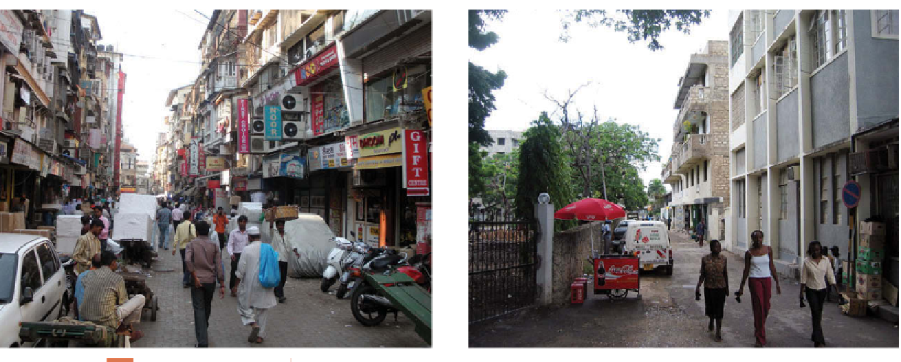
Figures 1.9, left and right
Mumbai, India (left) and Dar-es-Salaam, Tanzania (right).
Apartment buildings through-
out Mumbai (formerly Bombay), India, are typically four stories with balconies. In Dar-es-Salaam,
Tanzania, this four-story walkup with balconies (right) stands where single-family African dwellings
once stood, refl ecting the sequential occupance of the city.
© Alexander B. Murphy.
the Germans were ousted, a British administration took
over the city and began yet another period of transfor-
mation. The British encouraged immigration from their
colony in India to Tanzania. The new migrant Asian
population created a zone of three- and four-story apart-
ment houses, which look as if they were transplanted
from Bombay, India (Fig. 1.9 left and right). Then, in the
early 1960s, Dar es Salaam became the capital of newly
independent Tanzania. Thus, the city experienced four
stages of cultural dominance in less than one century,
and each stage of the sequence remains imprinted in the
cultural landscape.
The cultural landscape can be seen as a kind of book
offering clues into each chapter of the cultural practices,
values, and priorities of its various occupiers. As geogra-
pher Peirce Lewis explained in
Axioms for Reading the
Landscape
(1979), “Our human landscape is our unwitting
autobiography, refl ecting our tastes, our values, our aspi-
rations, and even our fears, in tangible, visible form.”
Like Whittlesey, Lewis recommended looking for layers
of history and cultural practice in cultural landscapes,
adding that most major changes in the cultural landscape
occur after a major event, such as war, an invention, or an
economic depression.
Geographers who practice fi eldwork keep their eyes open to
the world around them and through practice become adept
at reading cultural landscapes. Take a walk around your cam-
pus or town and try reading the cultural landscape. Choose
one thing in the landscape and ask yourself, “What is that and
why is it there?” How might the existence of that thing infl u-
ence the future development of the neighborhood? Take the
time to fi nd out the answers!
WHY DO GEOGRAPHERS USE MAPS,
AND WHAT DO MAPS TELL US?
Maps are an incredibly powerful geographic tool, and
cartography
, the art and science of making maps, is as old as
geography itself. (For details on cartography, see Appendix
A at the end of this topic.) Maps are used for countless pur-
poses, waging war, promoting political positions, solving