Geography Reference
In-Depth Information
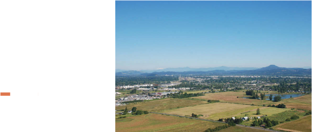
Figure 11.10
Willamette Valley, Oregon.
The township-and-
range system has left its imprint on the landscape
near Eugene, Oregon, where the grid pattern of six
mile by six mile townships and the sections of one
square mile each are marked by property lines and
roads.
© Alexander B. Murphy.
120
°
W
110
°
W
100
°
W
90
°
W
80
°
W
70
°
W
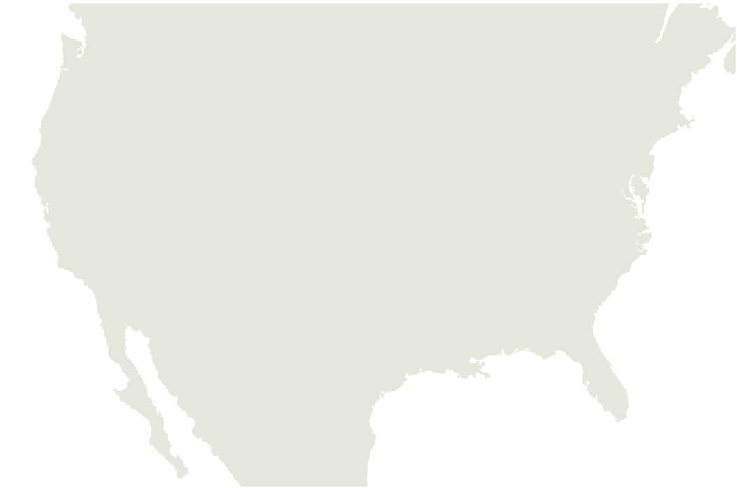
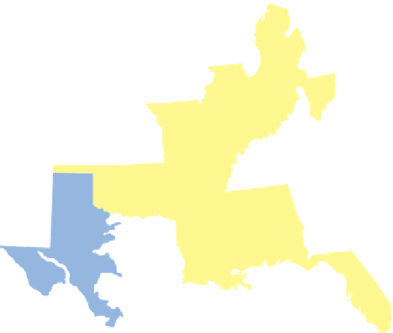
Federal rectangular grid
Long-lot survey system
0
200
400
600
800
1000 Kilometers
Irregular division in large estates
Metes-and-bounds survey
0
200
400
600 Miles
Rectangular grid of states
and land companies
Irregular rectangular division
Land settled and subdivided
by townships
Figure 11.11
Dominant Land Survey Patterns in the United States.
Data from:
Price, Edward.
Dividing the Land:
Early American Beginnings of Our Private Property Mosaic.
Chicago: University of Chicago Press, 1995, p. 8 and several other
sources.