Geography Reference
In-Depth Information
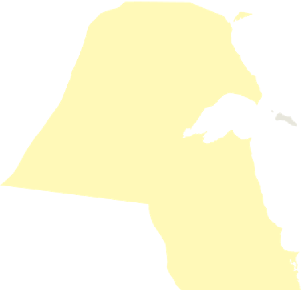
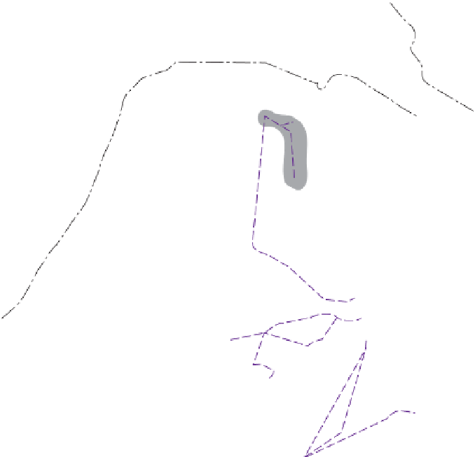
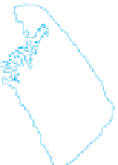
Figure 8.19
The International Boundary between
Iraq and Kuwait.
Kuwait's northern
boundary was redefi ned and delimited by
a United Nations boundary commission; it
was demarcated by a series of concrete pil-
lars 1.24 miles (2 kilometers) apart.
© E. H.
Fouberg, A. B. Murphy, H. J. de Blij, and John Wiley &
Sons, Inc.
extend? Most states insist on controlling the airline traf-
fi c over their territories, but states do not yet control the
paths of satellite orbits.
Types of Boundaries
When boundaries are drawn using grid systems such as lat-
itude and longitude or township and range, political geog-
raphers refer to these boundaries as
geometric boundar-
ies
. In North America, the United States and Canada used
a single line of latitude west of the Great Lakes to defi ne
their boundary. During the Berlin Conference, colonial
powers used arbitrary reference points and drew straight
lines to establish the boundaries in much of Africa.
At different times, political geographers and other
academics have advocated “natural” boundaries over geo-
metric boundaries because they are visible on the landscape
as physical geographic features.
Physical-political
(also
called natural-political)
boundaries
are boundaries that
follow an agreed-upon feature in the natural landscape,
such as the center point of a river or the crest of a mountain
range. The Rio Grande is an important physical-political
boundary between the United States and Mexico. Another
physical-political boundary follows the crest lines of the Pyr-
enees separating Spain and France. Lakes sometimes serve as
boundaries as well; for example, four of the fi ve Great Lakes
of North America are borders between the United States
Establishing Boundaries
States typically
defi ne
the boundary in a treaty-like legal
document in which actual points in the landscape or
points of latitude and longitude are described. Cartog-
raphers
delimit
the boundary by drawing on a map. If
either or both of the states so desire, they can
demar-
cate
the boundary by using steel posts, concrete pillars,
fences, walls, or some other visible means to mark the
boundary on the ground. By no means are all boundaries
on the world map demarcated. Demarcating a lengthy
boundary is expensive, and it is hardly worth the effort
in high mountains, vast deserts, frigid polar lands, or
other places with few permanent settlements. Demar-
cating boundaries is part of state efforts to
administrate
borders—to determine how the boundaries will be
maintained and to determine which goods and people
may cross them. How a boundary is administered can
change dramatically over time, however (Fig. 8.20).