Global Positioning System Reference
In-Depth Information
Later, the peg and rope combination used for land surveying would be
replaced by the chain and compass. A
Gunter's chain
, developed in early-
seventeenth-century England (fig. 3.2), consisted of 100 iron links and was
66 feet long. This odd unit of distance survives today as the length of a
standard cricket pitch. A compass was used to determine direction, with an
accuracy of one-quarter of a degree at best (relative to magnetic north, of
course). Between them, the chain and compass enabled land surveyors to
estimate distance and direction.
GROMA
The Romans were not great scientists, but they excelled at construction
engineering, and this required surveying. The basic tools of Roman sur-
veyors were the water level and the
groma
, illustrated in figure 3.3. Very
likely the groma originated with the Babylonians, long before the Romans.
It was used to establish lines and perpendiculars to those lines, as when
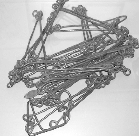
FIGURE 3.2.
A Gunter's chain. Named for the clergyman and mathematician who in-
vented it around 1620, this standard surveyor's chain was 66 feet long and consisted
of 100 links. A chain is the length of four
poles
. Ten chains make a
furlong
, with eight
furlongs per mile. An acre is thus one chain by one furlong.
From Wikipedia, courtesy of
Roseohioresident.