Global Positioning System Reference
In-Depth Information
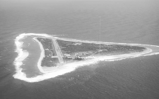
FIGURE 8.7.
The LORAN-C transmitter on Marcus Island, off the coast of Japan. When
constructed in 1964, the tower was 412 m high, and the transmitter power was 4 MW.
In 1985 the tower was replaced by one half as high and transmitting 1.1 MW. There
were hundreds of LORAN-C towers around the world during the four decades that
this system guided international air traffic.
U.S. Navy image.
solar flares. The accuracy of LORAN-C depended upon receiver range to
the transmitters. It could be used to estimate position to within 15 m if all
three towers were within 300 km, but if the transmitters were 1,500 km
away, accuracy was degraded to about 500 m.
13
Radar
Like its close relative LORAN, radar—an acronym for ''
ra
dio
d
etecting
a
nd
r
anging''—emerged from World War II as a mature technology, having
been developed rapidly during the war years. In fact, the radar technique
for spotting incoming airplanes had been hastily brought into service in
England immediately before the start of the war and proved itself during
the Battle of Britain. Radar would go on to prove decisive in another
13. For an easy-to-read nontechnical account of LORAN-C use, see Stearns (1980). A
technical summary is provided by Clausing (2007, pp. 156-65). There was an intermediary
version of this navigational network known as LORAN-B, never deployed widely, as well as
a military version, LORAN-D.